Iceland > Alternative Routes > Route Deascriptions
Summary
The concept of having this page is to enable the in-field team to have information ready at hand about various trails, so we can make more informed decisions in the field. The trail information includes information on distances, estimated time to complete, route notes, access to drinking water and any river crossing or significant obstacles.
The Base Route is divided into 8 sections, and is summarized as follows. Read the inidividual sections for more information. At the end of this page there is a summary for an example Alternative Route.
Route Surface Types
To help us plan a safer and more enjoyable journey, we’ve defined different surface types based on how developed or vehicle-accessible they are. Our goal is to avoid traffic and travel as much as possible on terrain where cars are unlikely or unable to go—so understanding the surface type helps us make better decisions along the way.
- Sealed. Paved roads with a hard surface like asphalt or concrete. Typically used by all types of vehicles and often busy.
- Gravel. Unsealed but improved and maintained roads made of compacted gravel. Usually suitable for 4×4 vehicles and light traffic.
- Dirt. Rough, unimproved roads or walking trails. These may be muddy, uneven, and dirt roads are only occasionally used by vehicles. Dirt roads and walking trails are either marked on maps or they are known to exist based on vehicle tracks visible in satellite imagery.
- Off-Trail. Completely natural terrain with no constructed path. We will make our our path.
Access to Drinking Water
If there is water shown on the maps or satellite imagery, we assume it is suitable for drinking. We carry filters and can boil water if needed. We can also take water from lingering snow and ice. Some water may contain high concentrations of heavy metals, and we will treat this water with activated carbon filtration.
Water Crossings
Probably the most difficult obstacle to assess in advance. Water levels are often seasonal or subject to recent weather conditions, either sunny days causing melt or rainy days. The analysis below is a best guess. A week prior to leaving we hope to be able to check recent satellite imagery, but the reality is will we find out how bad the rivers are when we get to them. Rivers banks may have quicksand. And this is what makes this an adventure.
Sources of Route Information
The information below is based on our best understanding from a combination of publicly available resources. We’ll find out just how accurate it is once the trip is complete! Our main sources include:
- Gaia Overland Map which is based on Open Street Maps. This source includes public tracks.
- Satellite imagery from maps.is
- The Vatnajökull National Park website, which also provides brochures for other national parks and areas in Iceland
- 1:300,000 series regional maps published by Mál og Menning.
1 – Norðurþing Area
Section 1 starts at Hraunhafnartangi Lighthouse and ends at Ásbyrgi Campground. It is 81 kms and will take 3 to 4 days to complete.
Norðurþing is the area is in the far North of the northeastern region of Iceland and where the trip starts. There is a gravel road, the Norðausturvegur Costal Road (870), from Hraunhafnartangi Lighthouse to Kópasker, after Kópasker the road to Ásbyrgi is sealed. The base route initially crosses the tundra but after Kópasker it follows the sealed road.
There are several route options across the tundra, including the base route and alternatives β-2 and β-3. These primarily follow established dirt roads and trails, though some parts will require navigation across open tundra. We will assess the terrain and drinking water availability once there. Our maps indicate several lakes that likely provide year-round water, which we presume to be drinkable. Others have successfully crossed this area, and we do not anticipate major difficulties with the tundra. In case of issues with water or weather, we can either retreat to the nearby gravel road or continue on to Kópasker, where there is a campsite (Tjaldsvæði Kópaskers). We remain relatively close to civilization at all times. There are no major rivers to cross.
A less interesting alternative, β-1, is to follow tertiary gravel roads and skip much of the tundra.
2 – Ásbyrgi and Dettifoss Areas
Section 2 starts at Ásbyrgi Campground and ends at Dettifoss Carpark. It is 32 kms long and will take 1 to 2 days to complete.
The canyonlands of Jökulsárgljúfur offer visitors the perfect opportunity to experience and enjoy unique nature, first protected as a national park in 1973. Ásbyrgi, Dettifoss, Vesturdalur, Hljóðaklettar and Hólmatungur are Jökulsárgljúfur’s most popular places to visit. There is also a trail connecting Dettifoss and Ásbyrgi, usually hiked in two days, with backpackers taking advantage of the basic campground in Vesturdalur.
There is so much information about this area in the super handy brochure. There is also a very cool 3d map.
Since this area is so well documented, there is no need to add more information. There are no significant obstacles to avoid and there is adequate access to drinking water. The Ásbyrgi and Dettifoss area is part of the Vatnajökull National Park and is therefore subject to camping regulations.
3 – Lake Eilífsvötn Area
Section 3 starts at Dettifoss Carpark and ends at Viti Crater Lake Carpark. It is 28 kms long and will take 1 to 2 days to complete
The first 15 kms of this section follow existing dirt tracks. The second half is off-trail, so we will be making our own path. Others have walked this way in the past; this is encouraging.
The route gains some elevation as it approaches the geothermal area around Krafla Peak and Viti Crater Lake. The path appears to follow dry river beds, so this could be quite slow going. The route for last few kilometers before Viti Crater Carpark is particular unclear. There are a few existing dirt tracks, but we will likely be doing a fair bit of route finding. The base route passes within a few kms of Lake Eilífsvötn and the Hliðarhagi Hut, and either of these could be good camping opportunities. There is drinking water at Lake Eilífsvötn and likely water before Viti Crater.
4 – Mývatn Laxá Region
Section 4 starts at Viti Crater Lake Carpark and end at the Southern edge of the National Park. It is 55 kms long and will take 2 days to complete.
The Mývatn area has unique geological and biological conservation values. Precipitation is trapped by the porous volcanic bedrock and moves beneath the surface until it reappears in a series of springs which supply systems of rivers and lakes. The largest of these is the wetland area of Mývatn and Laxá. Lake Mývatn (37 km²) is situated 278 meters above sea level and contains more than 50 islands. The landscape around the lake and in many of the islands is dominated by perfectly shaped pseudo craters, formed by steam explosions as hot lava flowed into the lake some 2300 years ago. The best known of the craters are Skútustaðagígar, which has a special protection status.
The name of the lake, Mývatn, derives from the vast numbers of midges (aquatic insects) that emerge from the lake, forming impressive mating swarms on its shores.
The Mývatnssveitarvegur Road (848) from Reykjahlíð to the southern end of Lake Mývatn is along a sealed road. The rest of the route is gravel road. So route navigation will not be a problem. There is lots to see and do in this area, and we have the option of many alternative routes. All the alternative routes still follow gravel roads or dirt tracks.
There are three river crossings.
- WC-4-1 : 178.2 kms (65.43906º, -17.05756º) – is likely dry.
- WC-4-2 : 179.6 kms (65.43114º, -17.07692º) has a bridge
- WC-4-3 : 188.5 kms (65.35551º, -17.09273º) could be challenging. Fortunately there is a detour we can take around the river which is 5.5 kms long vs the original 3 kms.
After we leave civilization (154 kms), drinking water is available at Lake Grænavatn (165 kms) or from Kráká River (171 kms). Rivers at WC-4-2 (180 kms) and WC-4-3 (189 kms) kms should have flowing and drinkable water. If not, we could push onto Botni Hut or the Suðurá River, another 7 kms along the route.
If we take the alternative route to Lake Askja via Heilagsdalur Hut (θ-1), then Section 4 ends at Heilagsdalur Hut. The total distance is a little shorter at 45 kms. The route follows gravel roads and dirt tracks and there are no river crossings. If we take the ζ-2 alternative route, then we will have 40 to 50 kms without access to drinking water, depending on if water is available at the cafe at Dimmuborgir. The same for the θ-1 alternative route, although it is shorter at 32 to 42 km. In both cases we will need to carry water for at least two days.
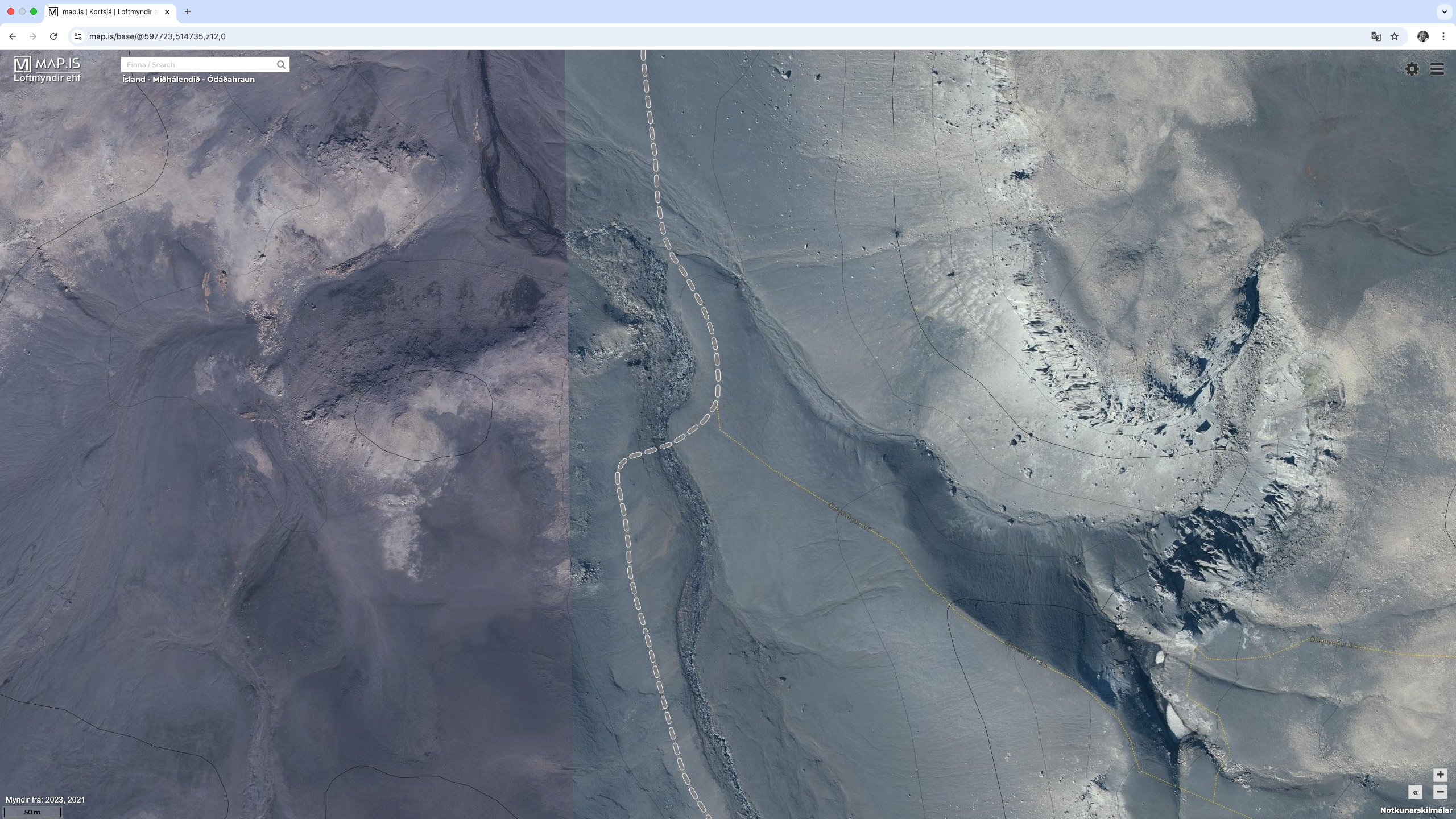
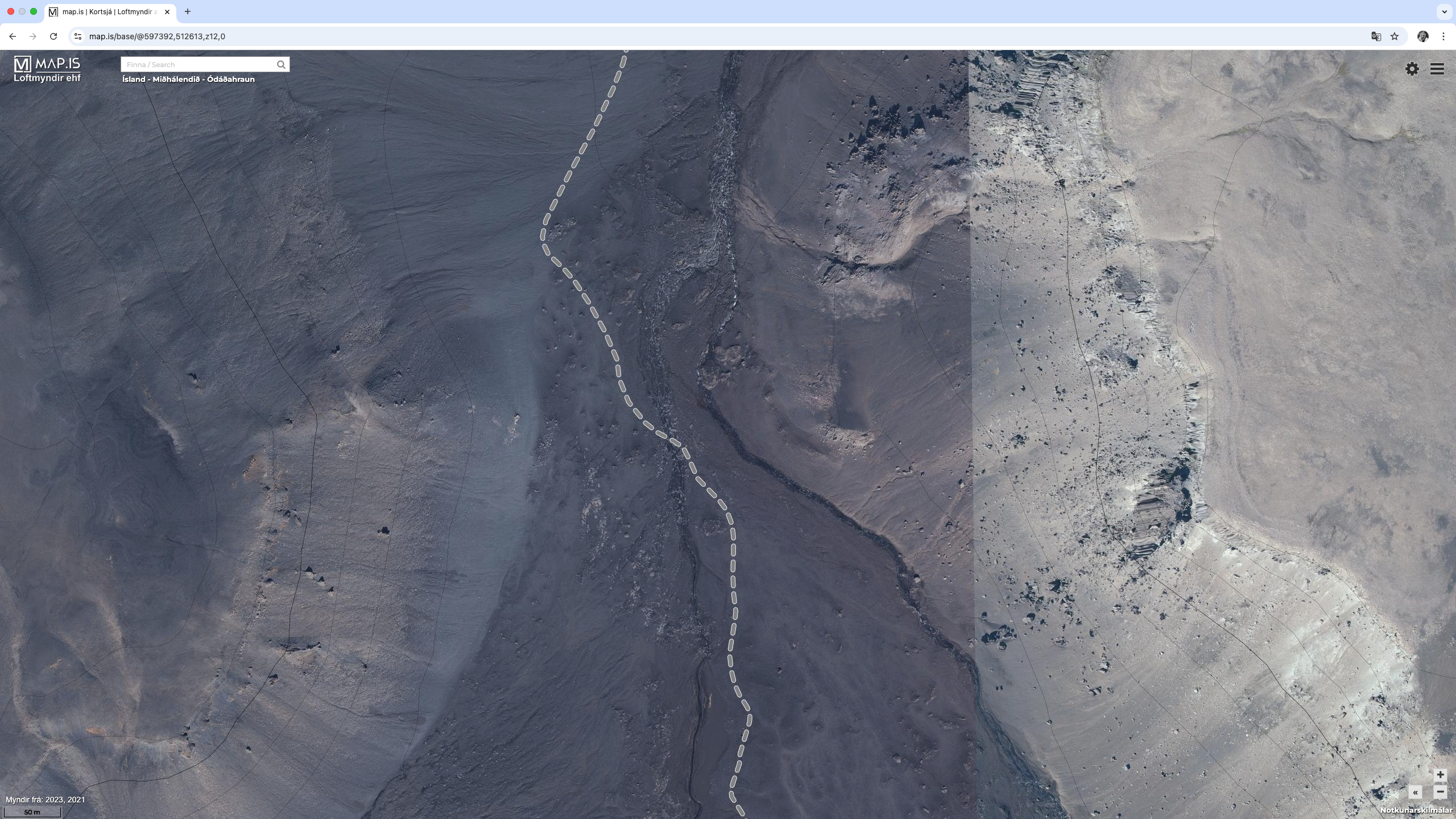
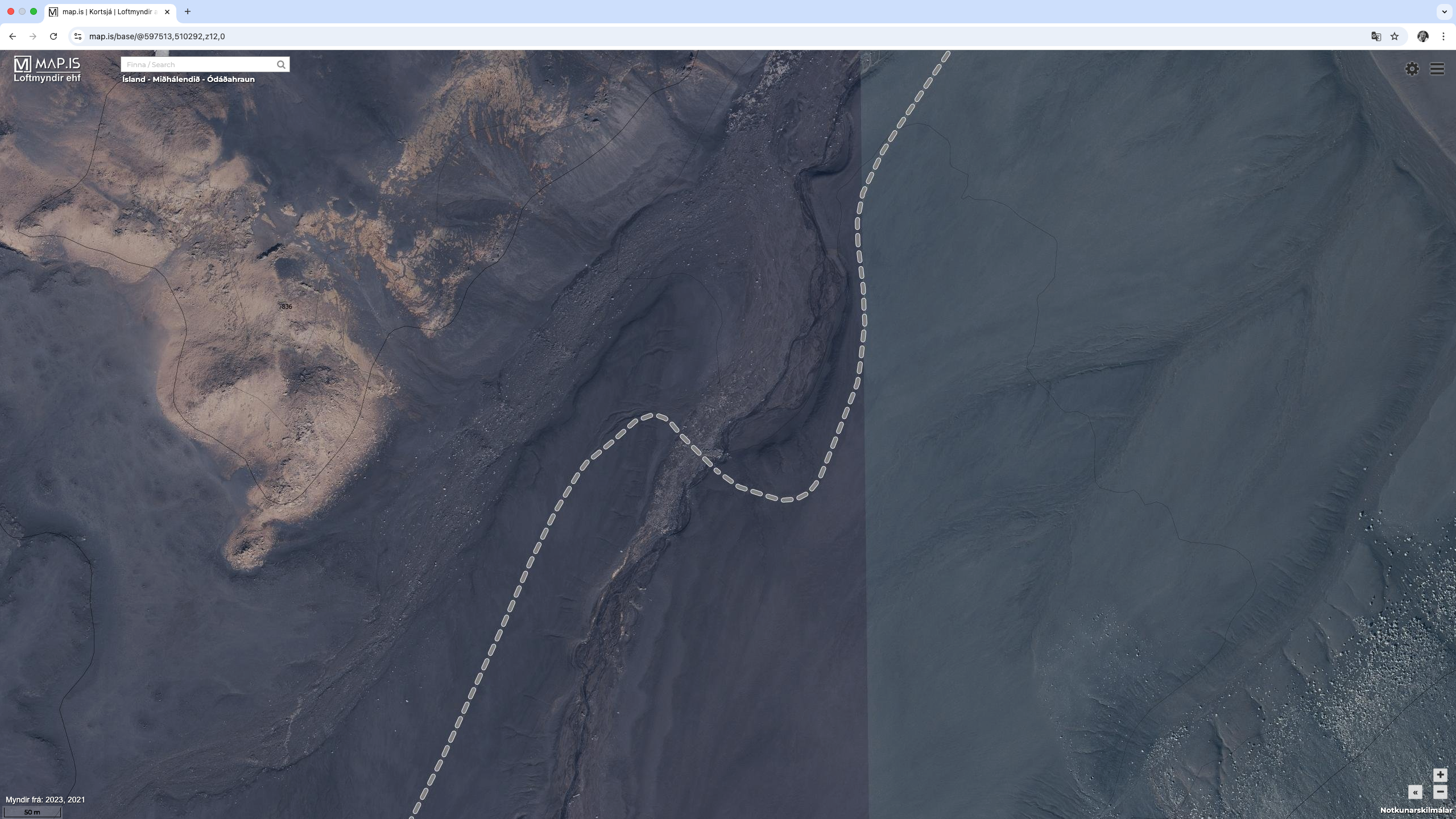
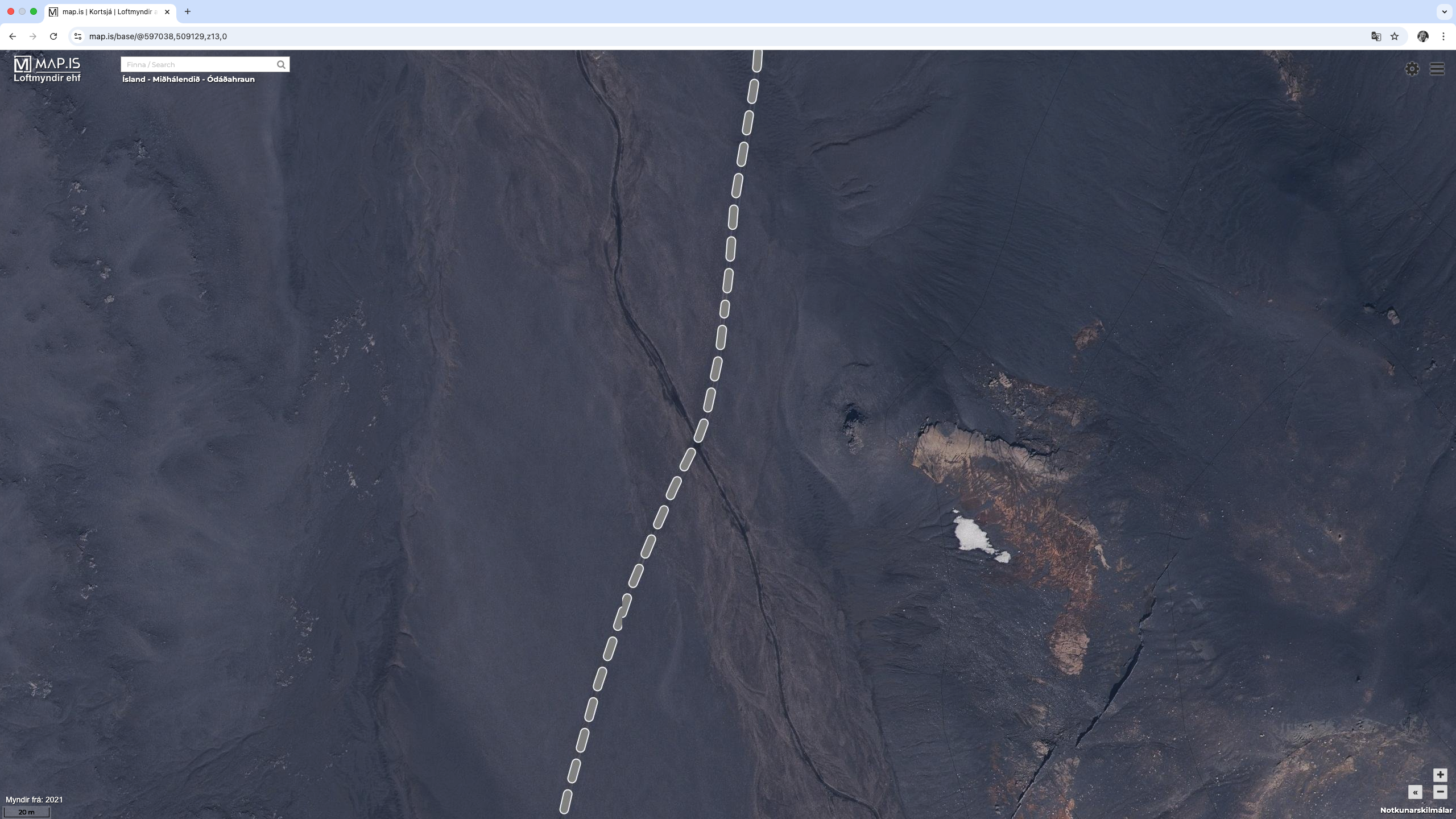
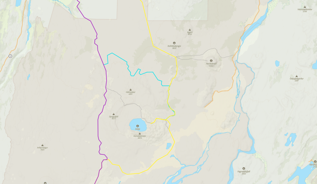
5 – Ódáðahraun Desert and Askja Area
Section 5 starts at the Southern edge of the National Park. and ends at Kistufell Hut. It is 79 kms long and will take 3 to 4 days to complete.
Askja is a fault trough in the central Dyngjufjöll, and it is the centre of a volcanic system with multiple eruptive fissures, including the Sveinagjár crater row. The Dyngjufjöll mountains formed in eruptions under an Ice Age glacier cap whilst Askja formed for the most part at the end of the Ice Age in a major ash eruption which caused the roof of the magma chamber at the heart of the central volcano to subside. What remained was a deep circular depression that gradually began to fill with lava from subsequent eruptions around the rim of the depression. The bottom of Askja (named after its caldera shape, Askja meaning caldera in Icelandic) is currently at an altitude of 1,100 meters while the rim edges are approximately 1,300 to 1,500 m above sea level. Similar formations in other central volcanoes are all referred to as Askja (plural “öskjur”).
During the summertime, park rangers are stationed at Drekagil and Herðubreiðarlindir Springs. They provide information, interpretation and they supervise the highlands north of Vatnajökull. There is a parking lot and toilet facilities at Vikraborgir by Askja. During high season, a ranger is on site daily at Askja and guides visitors on organized walking tours.
The Askja area is part of the Vatnajökull National Park and is therefore subject to camping regulations. More information on the Askja area can be found here. The following link is useful to understand what huts and cabins are available in an emergency. Lake Askja is also called Öskjuvatn.
This section follows dirt tracks the entire way. The only significant obstacle will be river crossings, and there are a total of 5 of them. They are:
- WC-5-1 : 221.1 kms (65.11770º, -16.92004º) (image)
- WC-5-2 : 223.5 kms (65.09885º, -16.92845º) (image)
- WC-5-3 : 226.3 kms (65.07771º, -16.92660º) (image)
- WC-5-4 : 227.7 kms (65.06751º, -16.93768º) (image)
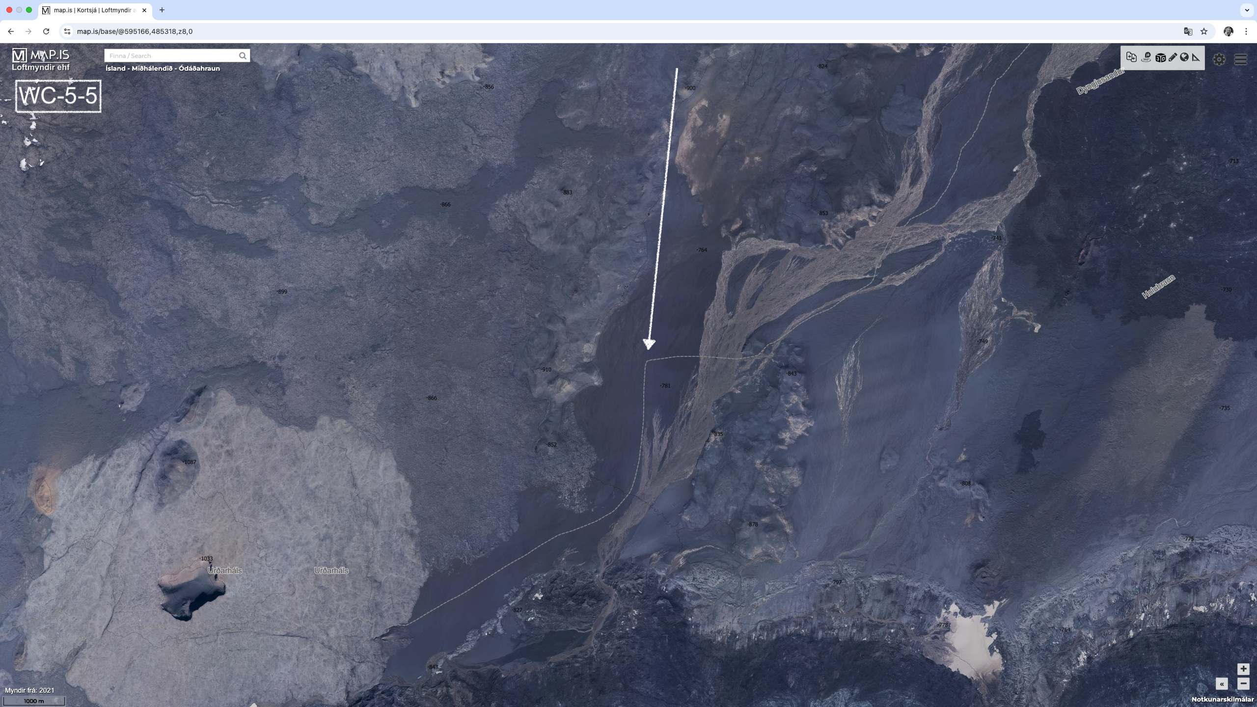
- WC-5-5 : 261.7 kms (64.82178º, -17.05733º) (image) (see notes)
Based on satellite imagery, WC-5-5 looks like a monster water crossing, potentially upto 1 km wide. There are many public tracks showing people have crossed this area. Looks like this river can be bypassed to the North, and maybe this is what others have done, just stayed to the North of the water. There is likely access to drinking water at
- Botni Hut (200 kms)
- Dyngjufell Hut (220 kms) from the nearby stream
- Around WC-5-5 (260 kms) from either the nearby river or the glacier
- Kistufell Hut at 272 kms.
A water carry is clearly required between the 220 kms and 260 kms marks.
There are quite a few alternative routes to consider.
5.1 – Dyngjufell Hut to Viti Carpark (θ-2)
This is a marked route from Dyngjufell Hut to the Carpark accessing Lake Askja and the crater lake or Viti. On the Vatnajökull National Park website, the trail is marked as the Ö3. The following links are useful:
- A somewhat useless description of the route on the Vatnajökull National Park website (link)
- Map of the trail, again from the Vatnajökull National Park website (link)
- 14 kms, Ascent 766m, Descent 303m.
Trail Notes: 150m after leaving the hut turn right onto the dirt track. Another 800m there is a fork to the left. There is a steady climb of 150m over the next 1km and another 500m is the first and only water crossing. Hard to tell if this crossing is difficult or not. After the water crossing rising again 100m over 1km. 1.75kms after the water crossing the river emerges on the right. Follow the river for 1.6kms before turning right and heading south. 2kms later should bring you to the top of the saddle or Jónsskarð Pass and an elevation of 1,250m. The pass is marked with yellow/red sticks and cairns. Another 500m on a decending route the trail turns East and follows the base of a ridge for another 1.5kms. After almost another 2kms, the trail heads north-east straight to the carpark. This route requires us to carry adequate water for the day.
WARNING: We may need to contend with snow on the ground. And this could make the route impassible. We have to check the conditions before taking this route, or be ready to turn back. We should not attempt this route in bad weather. Snow coverage appears to be more concentrated to the north-west of Lake Askja with the north-east and south-east more likley to be free from snow. As a consequence, the route approaching Lake Askja from the North and the route away from Lake Askja to the South are probably more likely to be passable.
5.2 Dyngjufell Hut to Dreki Hut (θ-3)
This is a longer route but avoids any issues with snow around the north-west side of Lake Askja. There is very little information on this route other than it is marked or documented on the map. There do not appear to be any significant obstacles on this route. This route is 43 kms long, with an ascent of 511m and a descent of 289m. The route leaves the base route 5kms before Dyngjufell Hut. The stream that feeds Dyngjufell Hut with water is 1km south of the turn-off to this route. So, potentially need to add 1 km to the total distance if we need to find water before heading in the direction of Dreki Hut. This route would take 2 days and we would need to carry water. You can see it is also not very straight.
5.3 Heilagsdalur Hut to Dreki Hut (θ-1)
The third option to Dreki Hut is from Heilagsdalur Hut across the Ódáðahraun desert. With a total distance is 56 kms. Not clear what the terrain is like, but guessing sandy lava field. It is 41 kms to Bræðrafell Hut, which will be locked and must be booked through a travel company. This hut might have water on small external rainwater water tanks. There also might be snow and ice on the ground, which would be good as we can make water. We will need to carry water for at least 2 days.
5.4 Dreki Hut South to Kistufell Hut.
The first 41 kms follows the Austurleið Road (F910), which is a dirt road. There are no river crossings. There are two choices at the 41 kms mark. Either a) continue north-west along the Austurleið Road to rejoin the base route at 243.7 kms (64.95543, -16.91656) or b) take short cut in a south-west direction along the Gæsavatnaleid trail #2 to re-join the base route at 260.6 kms (64.83196, -17.03252). The second option has some significant river crossings that are very wide, and the first option has none. The rivers crossings are marked on map as “A water that requires special care”. The first option adds 9 kms to the total distance.
There is a water source at 11 kms and 24 kms after leaving Dreki Hut. Taking the first option, it is 24.6 kms before the next water and a further 12 kms to Kistufell Hut. Somewhat ironic that one route might be impassible due to water and the other has none. With either option a water carry is not required. Filtering is a must however.
There are some reports of quick-sand, but not entirely sure where this quick-sand is.
5.5 Other Hikes around Lake Askja
There are other trails in the region that are shorter and already reasonably well documented. They include:
- A1 Vikraborgir – Öskjuvatn trail (link)
- A2 Dreki – Dyngjufjöll – Víti trail (link)
- A4 Dreki – Nautagil trail (link)
- Ö2 Bræðrafell – Drekagil (link)
- Ö1 Herðubreiðarlindir – Bræðrafell (link)
6 – Vonarskarð Area
Section 6 starts at Kistufell Hut and ends at Nýidalur Hut. It is 57 kms long and will take 2 to 3 days to complete.
Vonarskarð is notable among other things for the fact that it is the site of the water divide between north and south Iceland, and where the sources of both Skjálfandafljót and Kaldakvísl can be found. In the western part of Vonarskarð there is a geothermal high-temperature area, with nearly all the phenomena that are known to exist in such areas. This is a remote place, and although some believe that the settler Gnúpa-Bárður went through the pass during the Age of Settlement, the first recorded instance of anyone travelling in the area was about 1839. There is no road for cars that leads to Vonarskarð, but it can be reached on foot from Kolufell, Gjósta and Nýidalur.
More information can be found here. In this area there are marked trails that are suitable for people but not cars. The trails are very well documented by the National Park service. Below are short descriptions of the trails.
The base route follows the Austurleið Road (F910) and then joins the Sprengisandsleið Road (F26), so it is well known gravel roads the entire way. The major obstacle will be water crossings, and there are 14 of them on the base route. They are
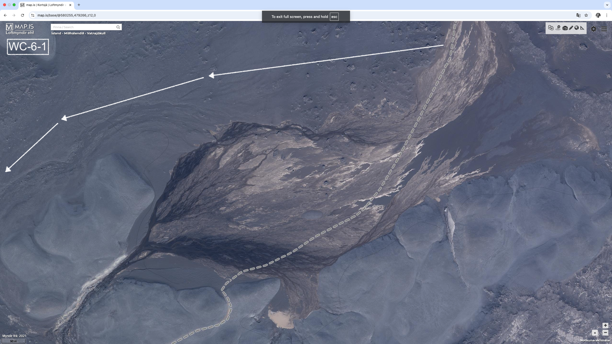
- WC-6-1 : 278.3 kms (64.80411º, -17.30769º) (image)
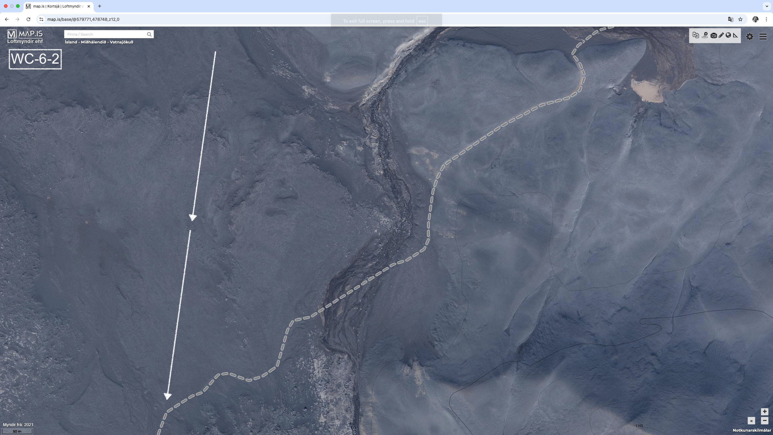
- WC-6-2 : 279.2 kms (64.79933º, -17.32165º) (image)
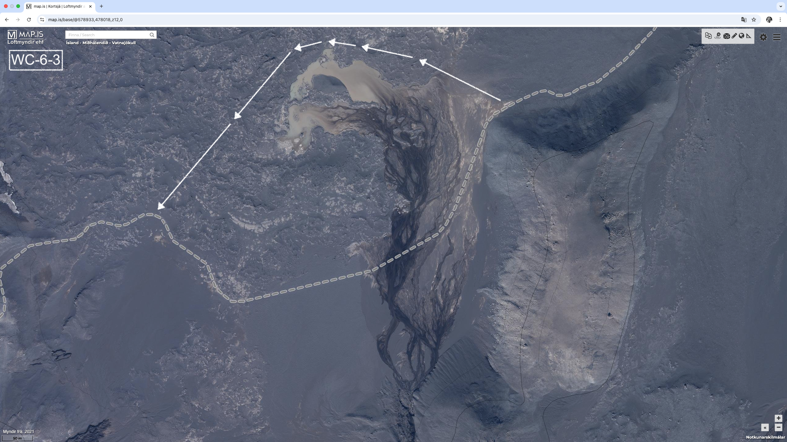
- WC-6-3 : 280.4 kms (64.79301º, -17.33903º) (image)
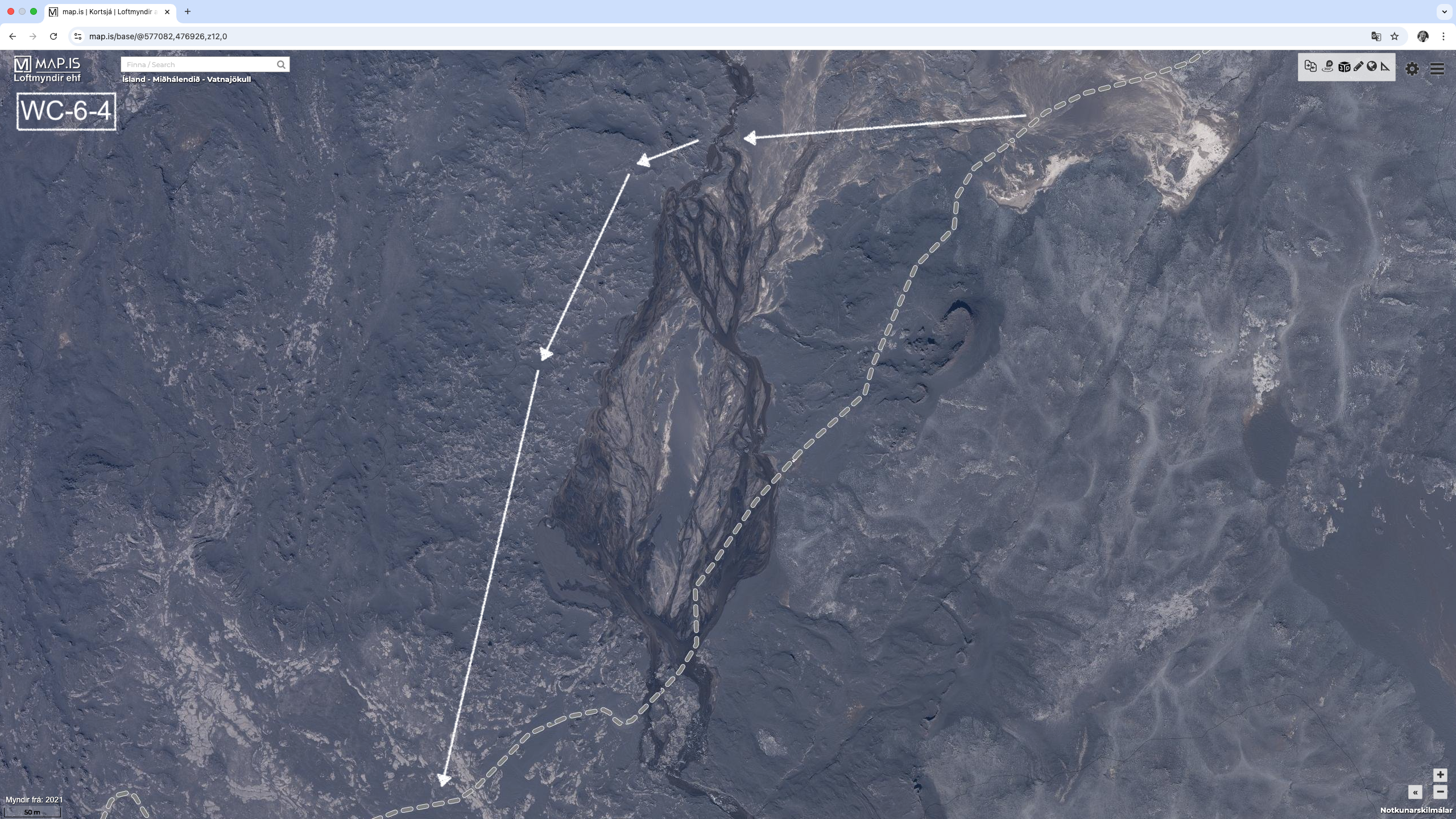
- WC-6-4 : 283.4 kms (64.78292º, -17.37958º) (image)
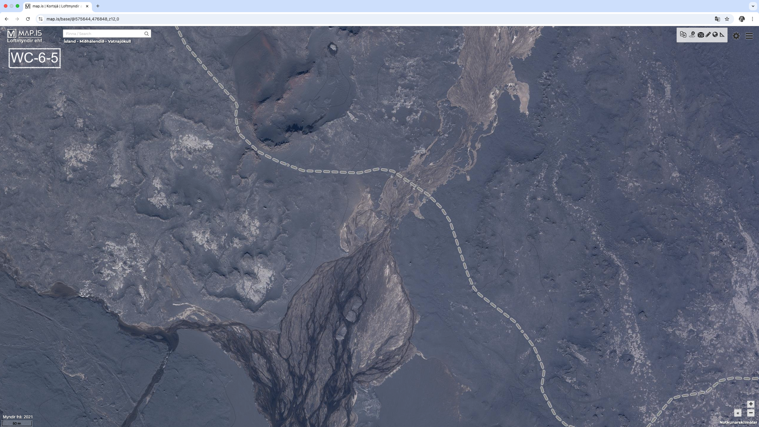
- WC-6-5 : 285.2 kms (64.78445º, -17.40814º) (image)
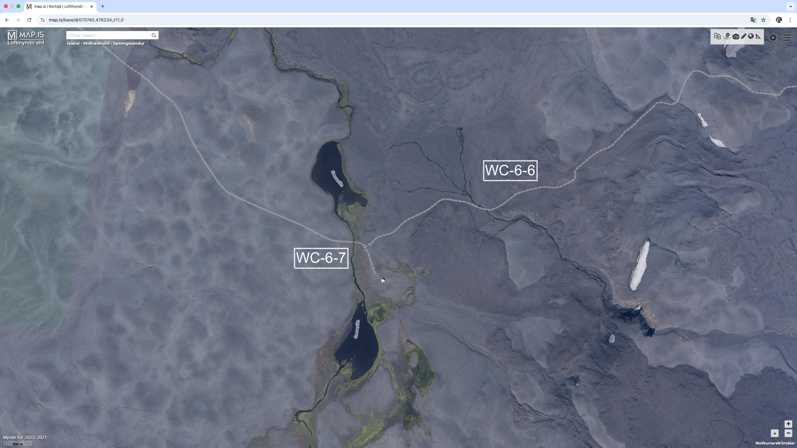
- WC-6-6 : 291.3 kms (64.78009º, -17.50667º) (image)
- WC-6-7 : 291.7 kms (64.77928º, -17.51563º) (image)
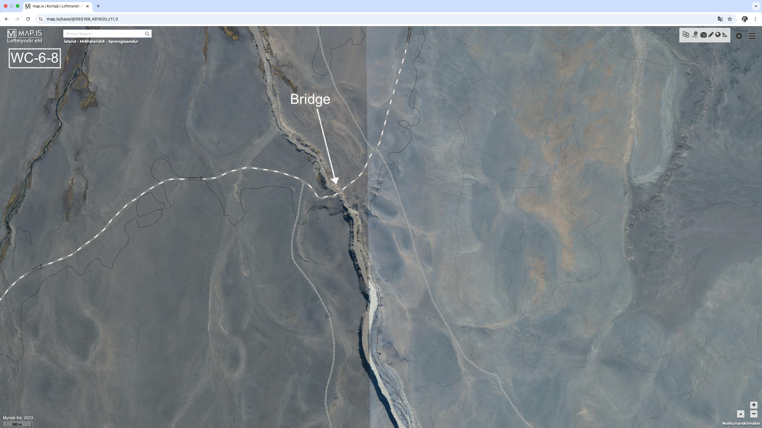
- WC-6-8 : 300.4 kms (64.82951º, -17.63020º) – Bridge over the Skjálfandafljót River (image)
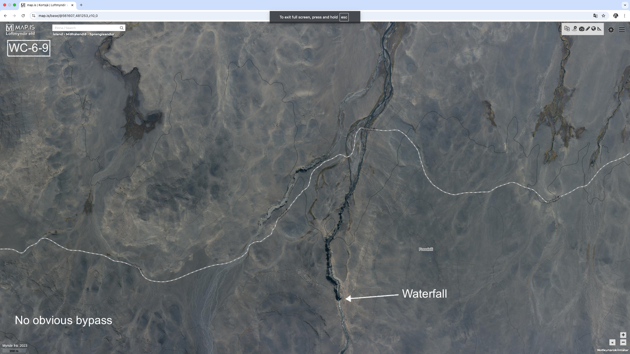
- WC-6-9 : 304.1 kms (64.82950º, -17.69533º) (image)
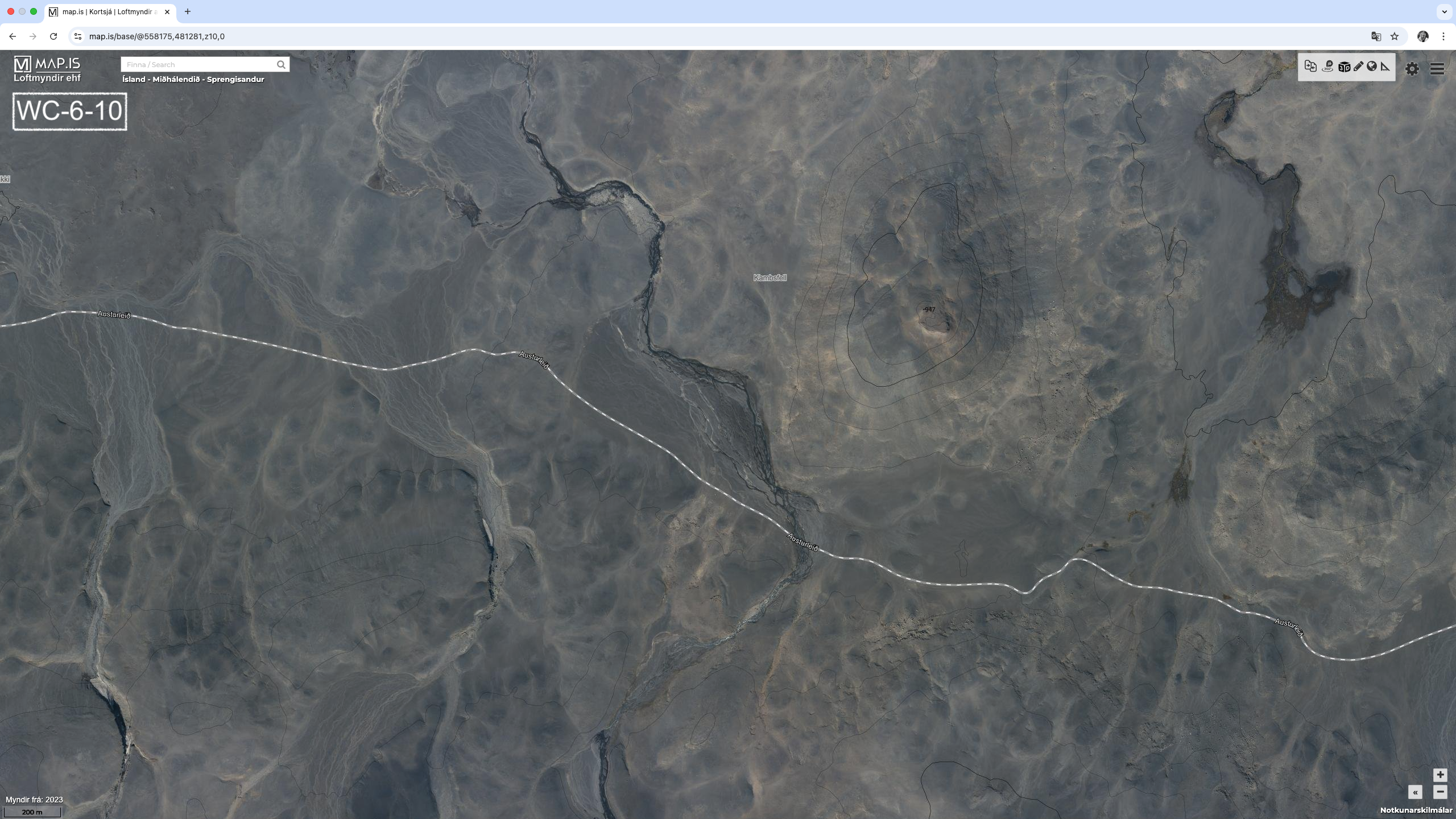
- WC-6-10 : 308.3 kms (64.82360º, -17.76914º) (image)
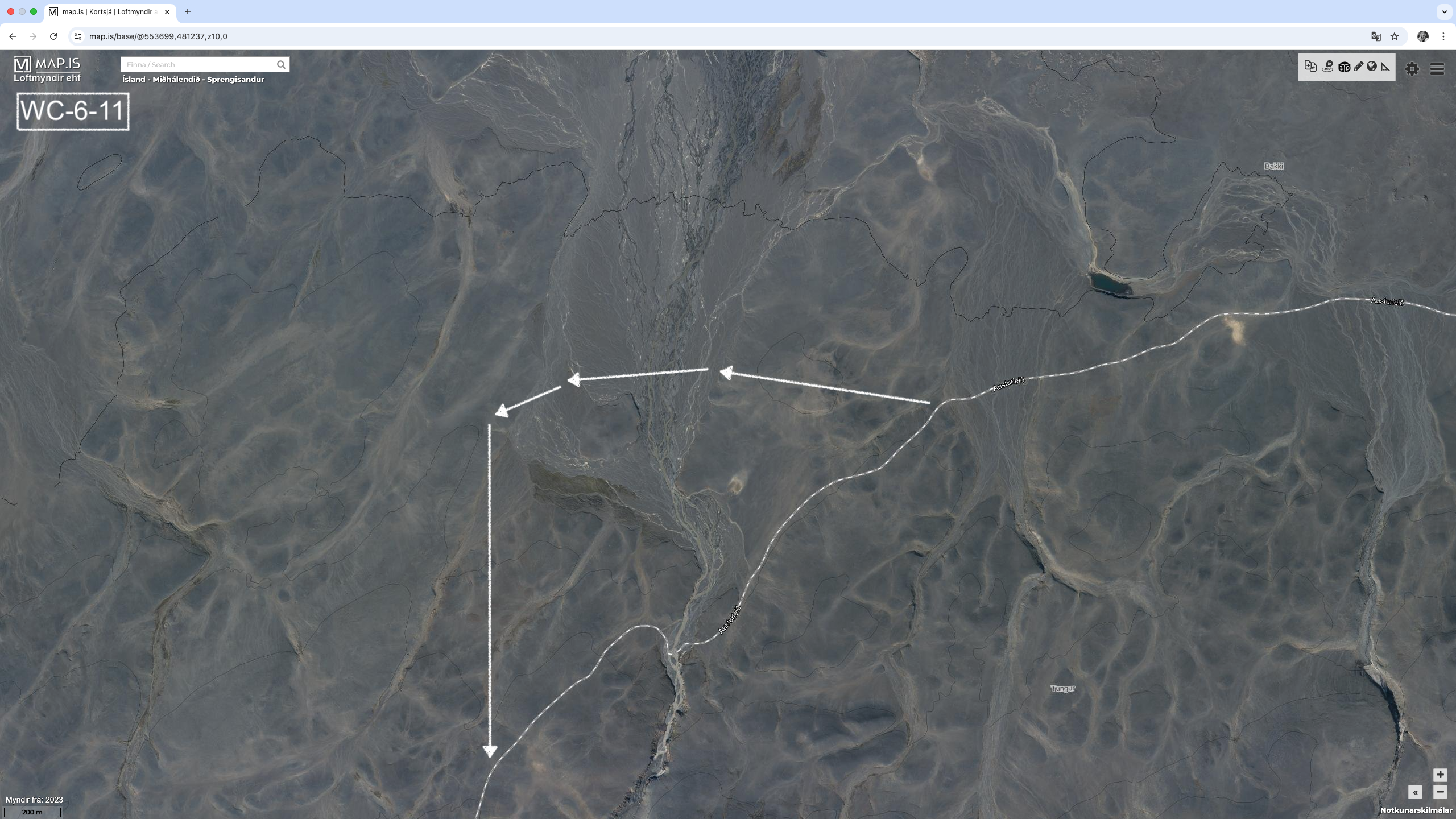
- WC-6-11 : 313.9 kms (64.82079º, -17.87277º) – Jökulfall River (image)
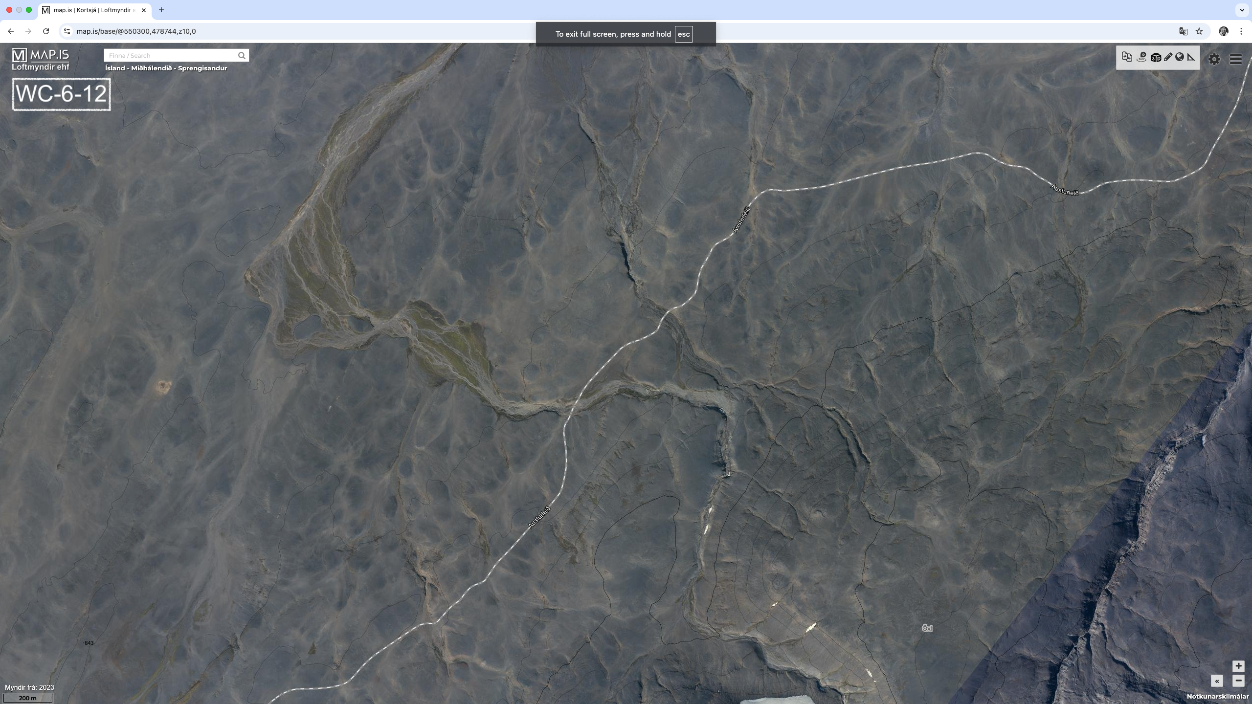
- WC-6-12 : 318.5 kms (64.80442º, -17.94575º) (image)
- WC-6-13 : 323.9 kms (64.77245º, -18.01995º) – Hagakvíslar River (image) – This could be a difficult crossing
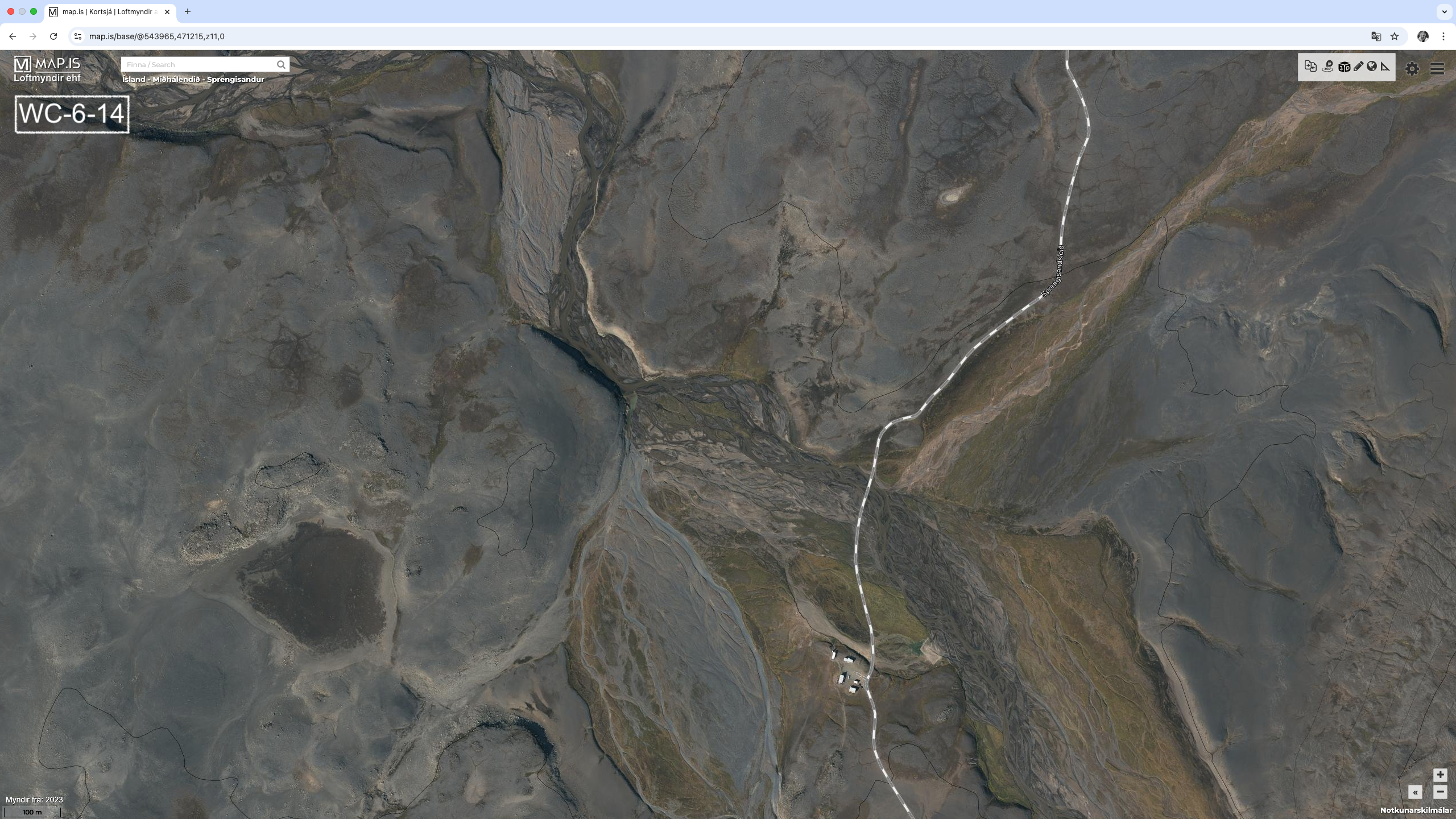
- WC-6-14 : 328.7 kms (64.73757º, -18.07229º) – Fjórðungakvísl River (image)
It appears that bypass routes are available for WC-6-1 through WC-6-5. In each case go North or downstream. The water is absorbed into the porous rock as it flows from the glacier. There are however two potentially more challenging crossings:
- The Jökulfall Rive (WC-6-11). There is likely a 3 km bypass, which adds 1 km to the route. Again the bypass is to the North or downstream.
- The Hagakvíslar River (WC-6-13). There is no obvious by-pass. The river looks to be only 5 or 10 meters across. If there is a bypass, then it is again to the North or downstream.
With all of this water, obtaining drinking water should not be too much of a problem. Filtering is a must however.
6.1 – Southern Route to Nýidalur Hut
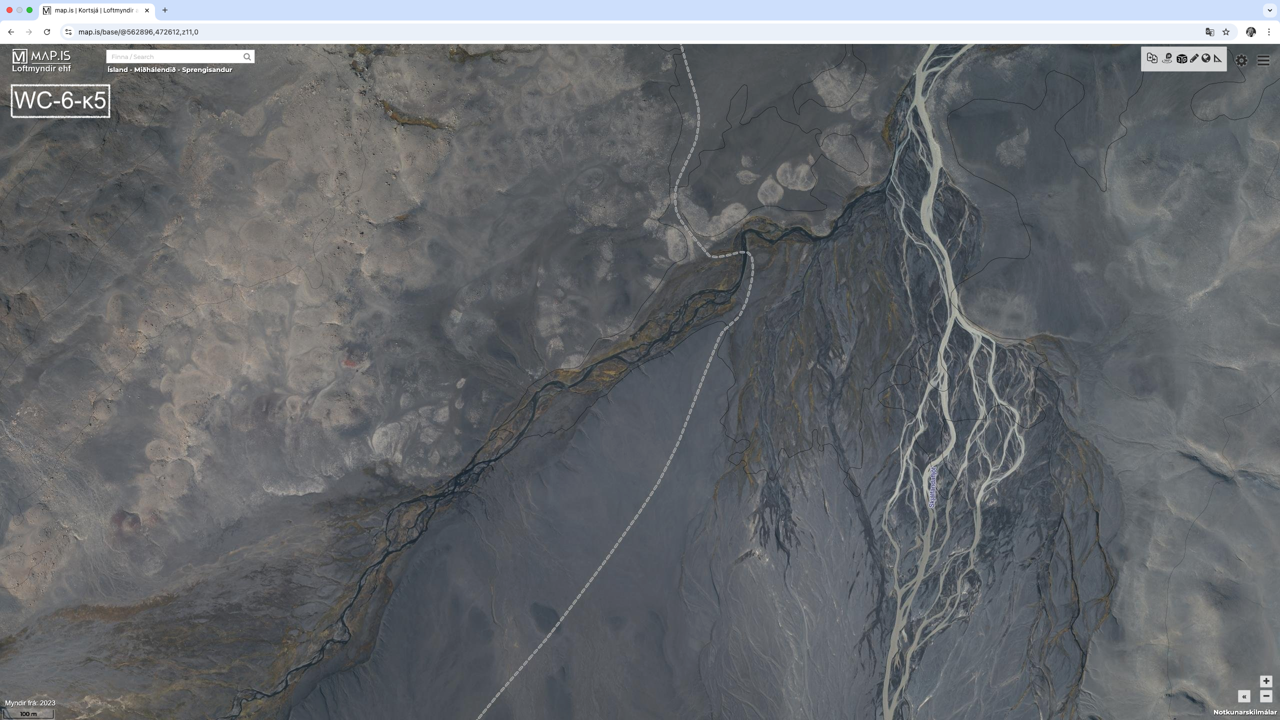
The Base Route passes to the North of Tungnafellsjökull Glacier. This is an alternative to Nýidalur Hut that passes between Tungnafellsjökull and Vatnajökull glaciers, or to the South of Tungnafellsjökull Glacier. It is 10 kms longer the base route, for total of 67 kms and would take 3 days to complete. It follows well documented dirt tracks. Again, river crossings will be the only real problem here. The section end point if this alternative is taken is Kolufell Trailhead.
There are 10 river crossings on this route.
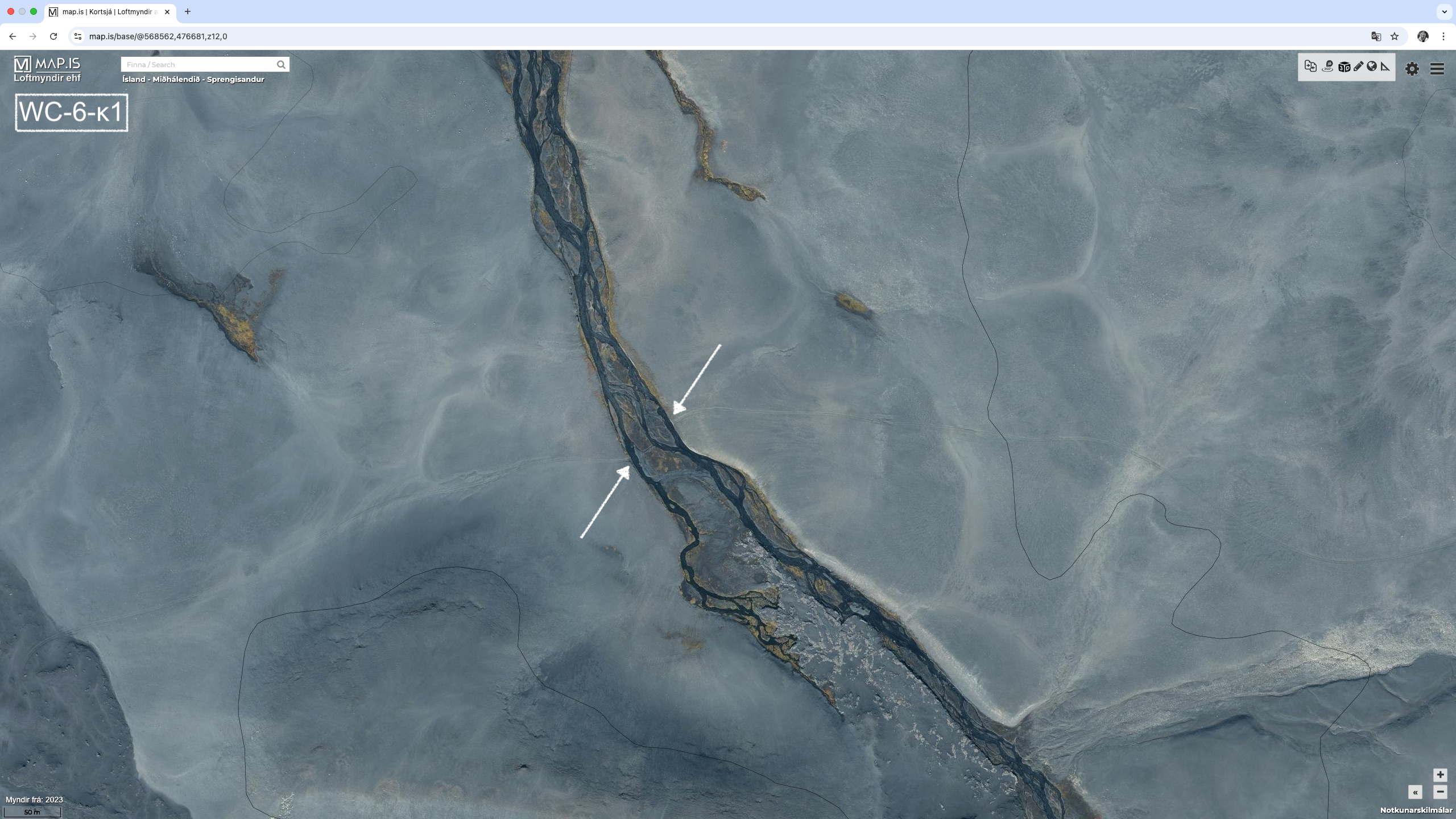
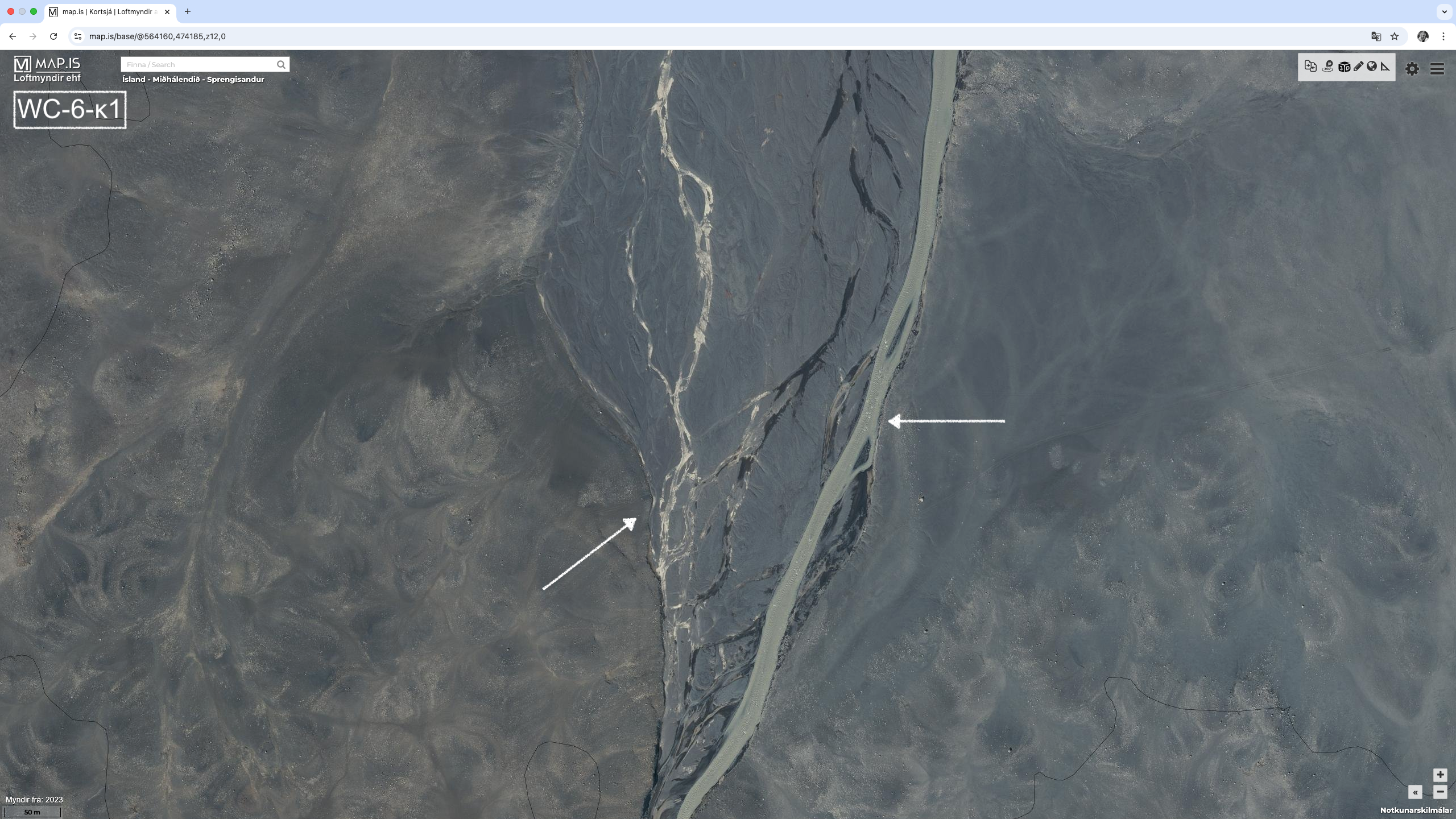
- WC-6-κ1 : (64.78379, -17.55946º) (image)
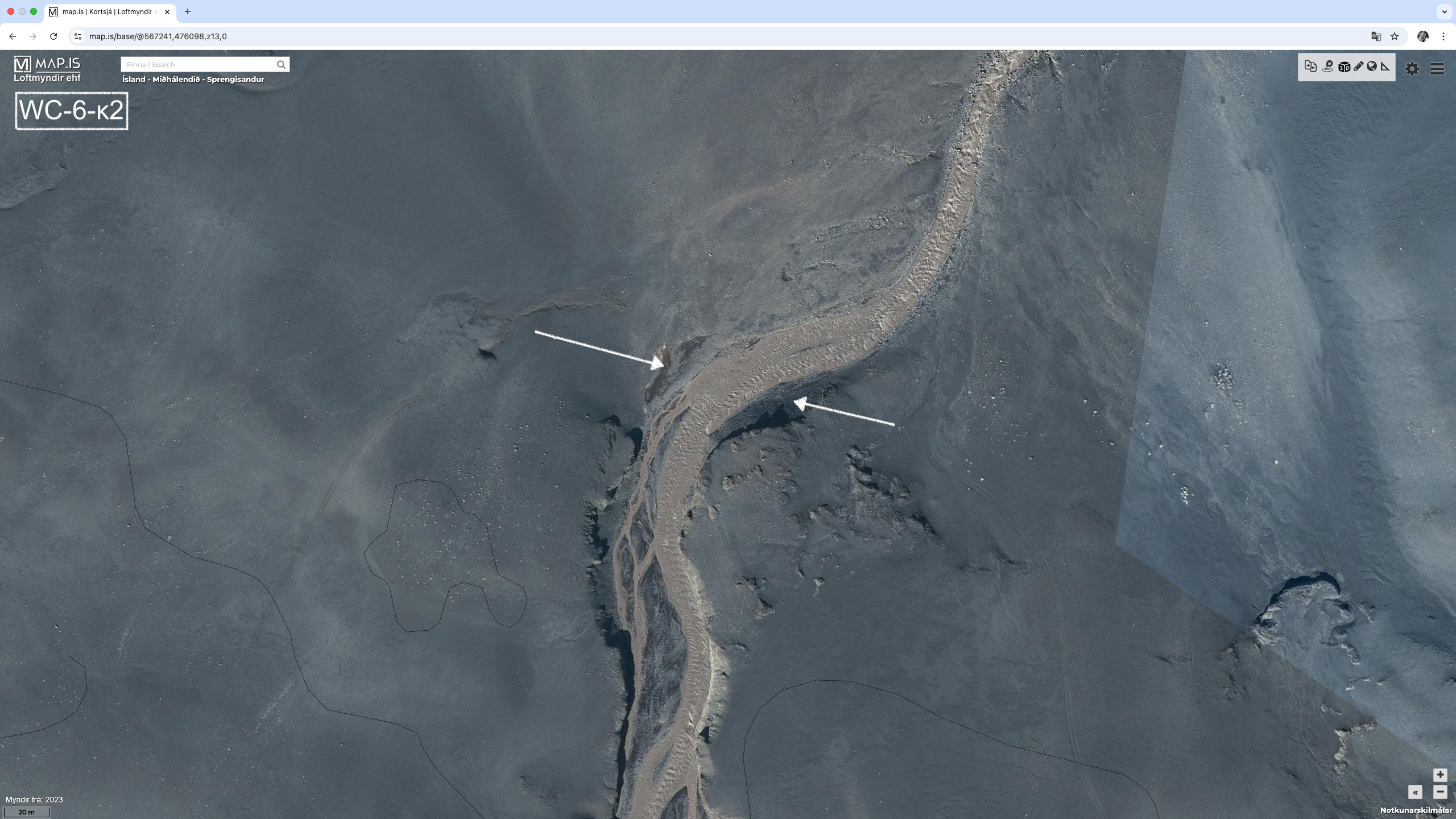
- WC-6-κ2 : (64.77907º, -17.58618º) (image) – Rjúpnabrekkukvísl River
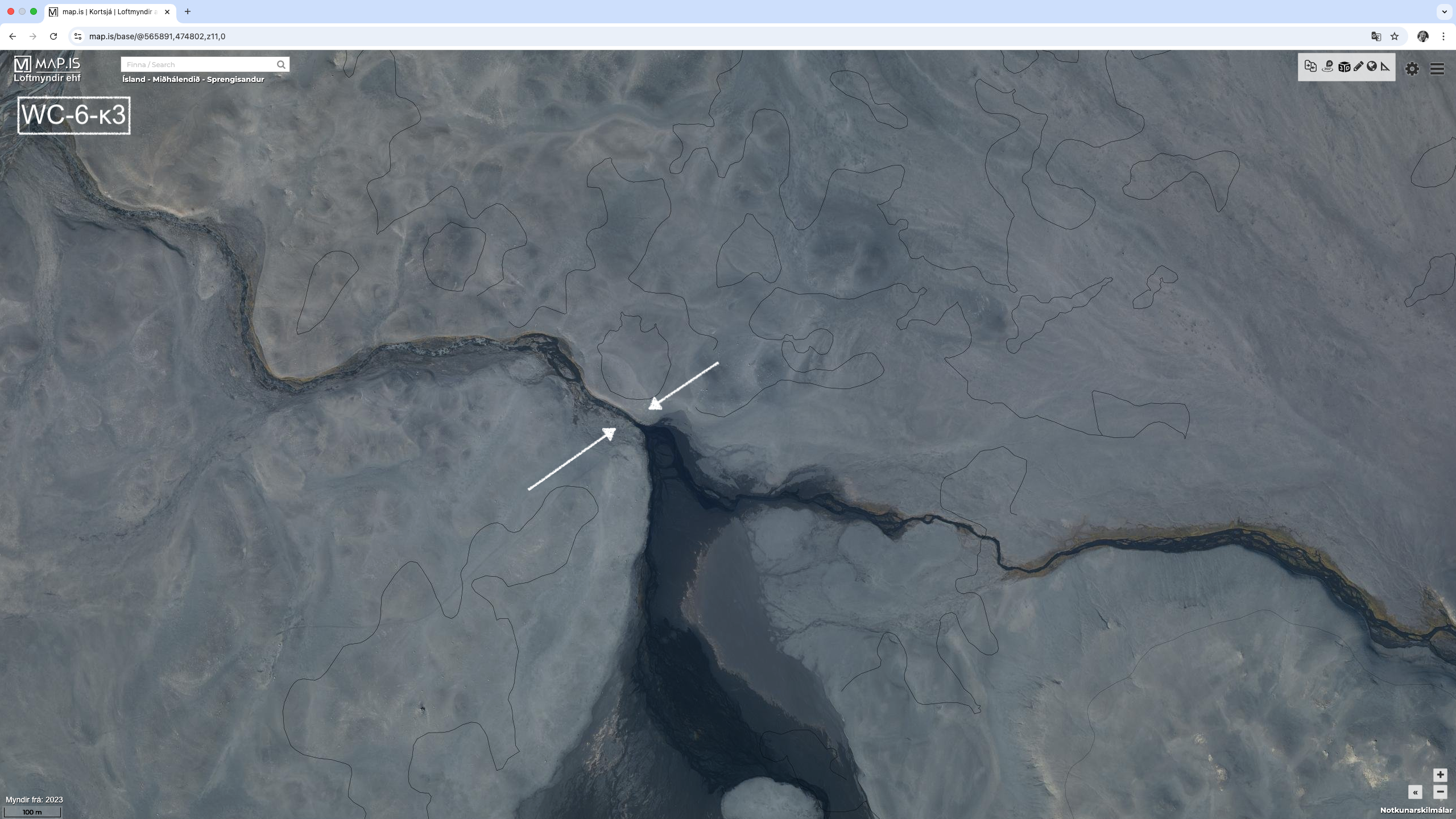
- WC-6-κ3 : (64.76770º, -17.61844º) (image)
- WC-6-κ4 : (64.76090º, -17.65099º) (image) – Skjálfandafljót River
- WC-6-κ5 : (64.75055º, -17.67447º) (image)
- WC-6-κ6 : (64.70458º, -17.77811º) (image)
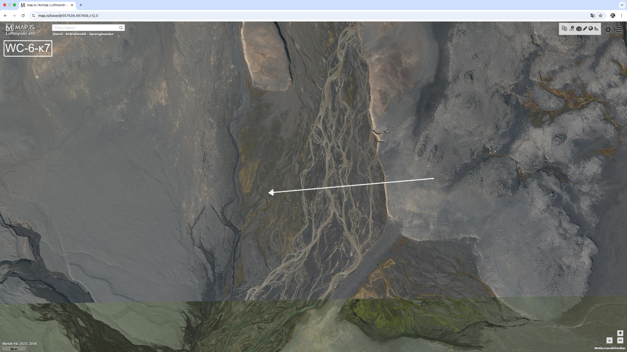
- WC-6-κ7 : (64.70208, -17.79270º) (image) – Rauðá River
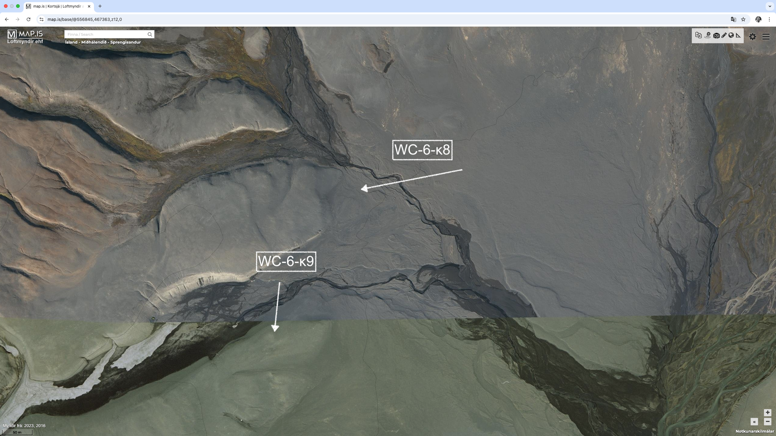
- WC-6-κ8 : (64.70208º, -17.79270º) (image)
- WC-6-κ9 : (64.70169º, -17.81019º) (image)
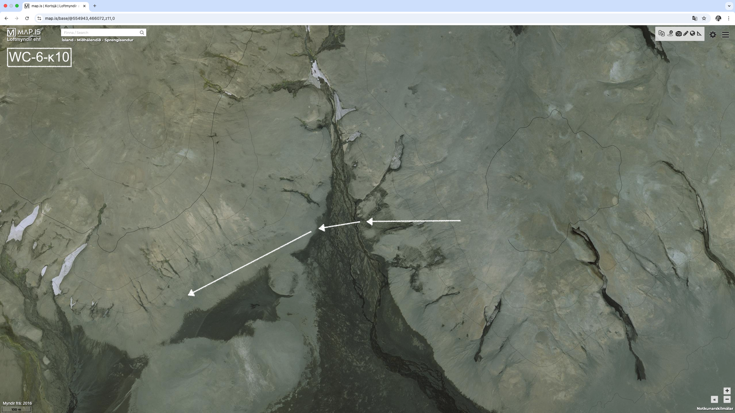
- WC-6-κ10 : (64.69107º, -17.84994º) (image)
Crossing the Skjálfandafljót River (WC-6-κ4) is going to be the most problematic. Fortunately WC-6-κ1 through WC-6-κ4 can be bypassed by going up to WC-6-8 where there is a bridge. This is longer, with the original 10 km route becomes 18 kms.
The Rauðá River (WC-6-κ7) seems to be sufficient braided to allow a crossing. There does not appear to be a good bypass. The rest of the crossings appear to be ok.
Again, drinking water should no be a problem in this area.
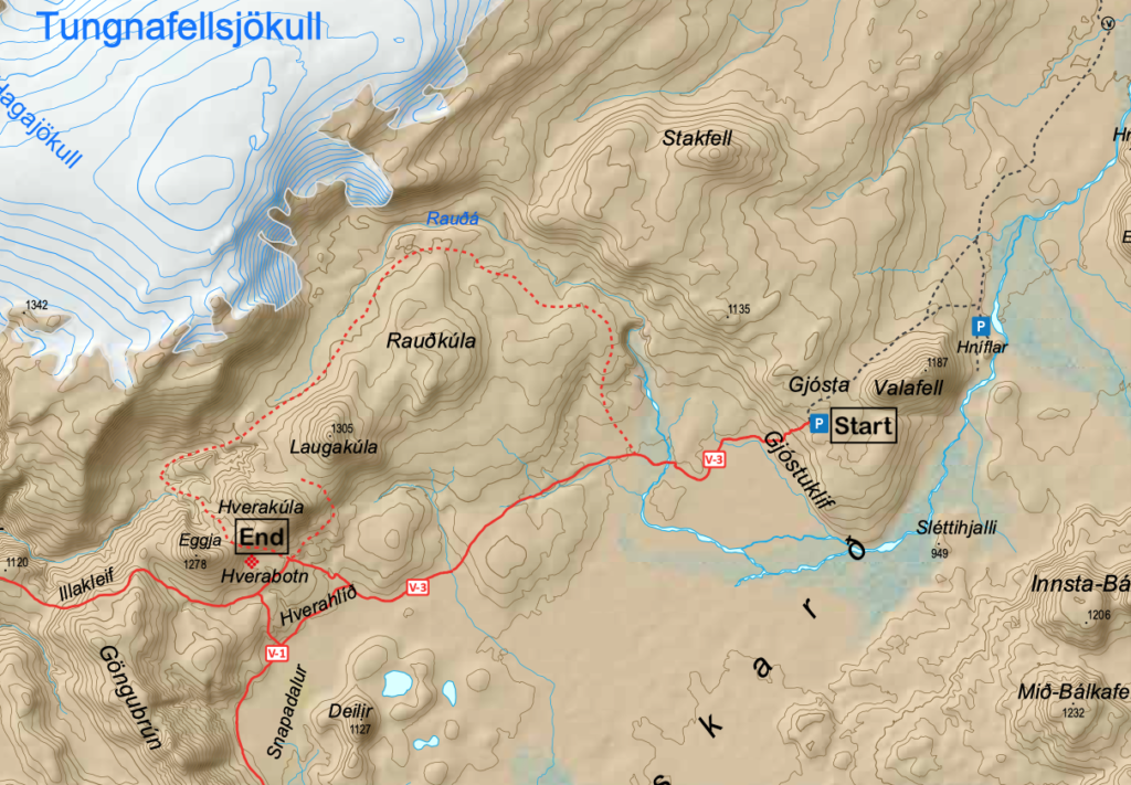
6.1.1 – Gjósta to Vonarskarð
On the Southern Route to Nýidalur Hut, there is a marked route from Gjósta Car Park to Vonarskarð Geothermal Area. On the Vatnajökull National Park website, the trail is marked as the N9. However the map from the same organization has it marked as the V-3. The following links are useful:
- Description of the route on the Vatnajökull National Park website (link)
- Map of the trail (link)
- 8 to 9 kms, 5 to 6 hours, challenging.
The trail follows Gjóstukleif, down into Vonarskarð and on to the Hverahlíð high temperature geothermal area. Views of Vonarskarð and the water-shed, barren landscape and high temperature geothermal area. Warning no cell or tetra coverage in Vonarskarð.
6.1.2 – Nyidalur to Vonarskarð
This is a marked route from Nýidalur Hut to the Vonarskarð Geothermal Area. It can be taken in either direction. On the Vatnajökull National Park website, the trail is marked as the N6. However the map from the same organization has it marked as the N-4. The following links are useful:
- Description of the route on the Vatnajökull National Park website (link)
- Map of the trail, again from the Vatnajökull National Park website (link)
- 13 kms, 3 to 5 hours, Ascent 173m, Descent 530m, challenging.
The trail follows Mjóháls ridge into Vonarskarð and leads to the Hverahlíð high temperature geothermal area which has varied geothermal formations. From Mjóháls there is a magnificent view of Nýidalur and Tungnafellsjökull. There are no water crossings.

6.1.3 – Vonarskarð to Svarthöfði
This is a marked route from Vonarskarð Geothermal Area to Svarthöfði Car Park. On the Vatnajökull National Park website, the trail is marked as the N7. However the map from the same organization has it marked as the V-1. The following links are useful:
- Description of the route on the Vatnajökull National Park website (link)
- Map of the trail (link)
- 6.5 kms, 3.5 hours, challenging.
A hike from the Hverahlíð high temperature geothermal area, along the slopes of Skrauti into Snapadalur and then over the pass between Svarthöfði and Kolufell. Magnificent landscape, rhyolite screes, alpine vegetation and high temperature geothermal area.
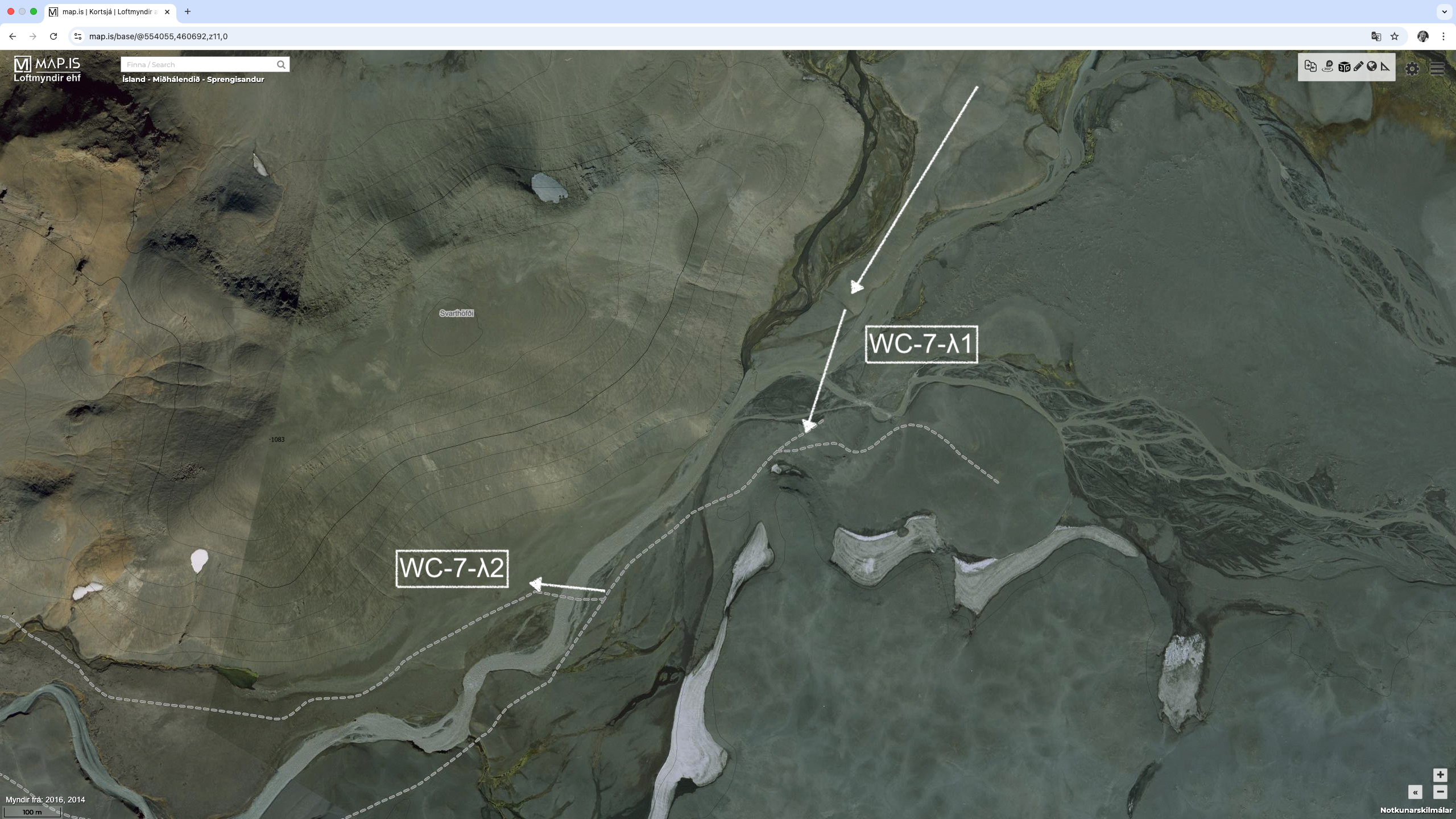
There is an alternative route that goes on the Western side of Deilir and Svarthöfði. There are two river crossings at the end just prior to the Kolufell Trailhead. They are
- WC-6-λ1 : (64.64407º, -17.86466º) (image)
- WC-6-λ2 : (64.64056º, -17.87479º) (image)
If these two crossings are impossible, we can back track, or attempt to stay on the Western side of the river or even go over Svarthöfði peak. So, lots of options. Also, unlikely we will even go this way.
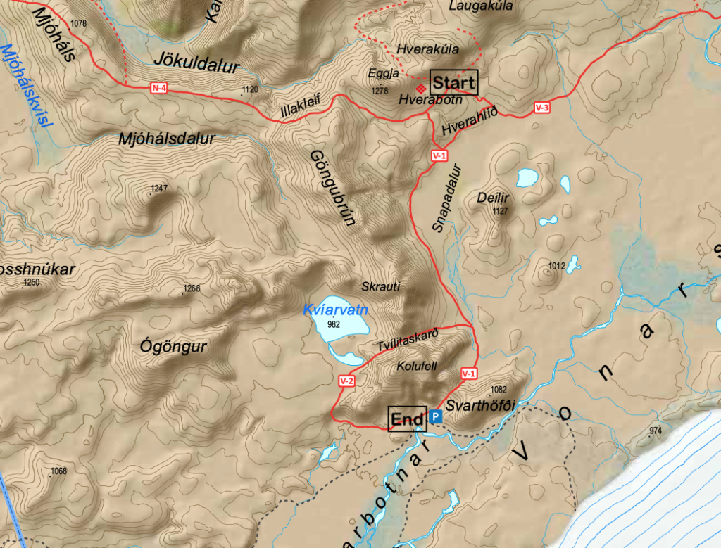
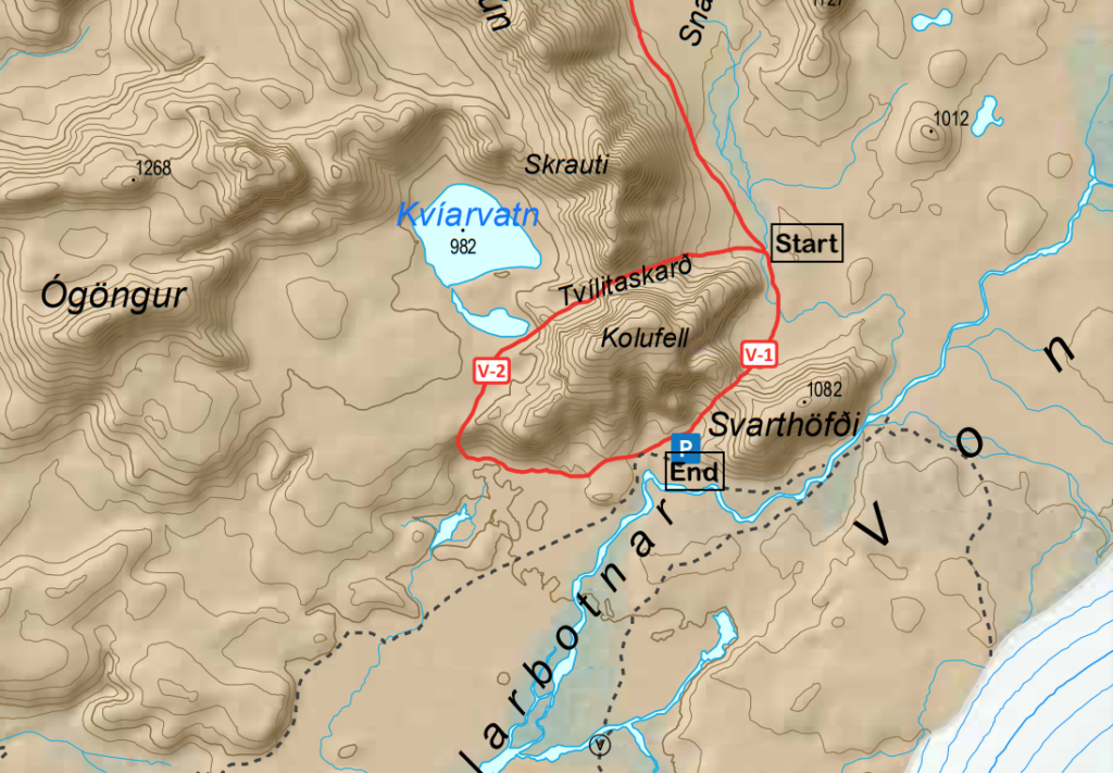
6.1.4 – Tvílitaskarð – Around Mt Kolufell
Potentially a marked route around Mt Kolufell. On the Vatnajökull National Park website, the trail is marked as the N8. However the map from the same organization has it marked as the V-2. The following links are useful:
- Description of the route on the Vatnajökull National Park website (link)
- Map of the trail (link)
- 9 kms, 3 to 5 hours, challenging.
A circular trail around Kolufell. View over Vonarskarð, varied hyaloclastite (móberg) and rhyolite formations with a peaceful mountain lake.
7 – Lake Þórisvatn Area
Section 7 starts at Nýidalur Hut and ends at intersection of the Sprengisandsleið (F26) and the Veiðivatnaleið (F228). It is 95 kms long and will take 4 days to complete.
The base route follows the Sprengisandsleið for the entire way, so route finding will not be a challenge at all. There are a total of 8 water crossings. They are:
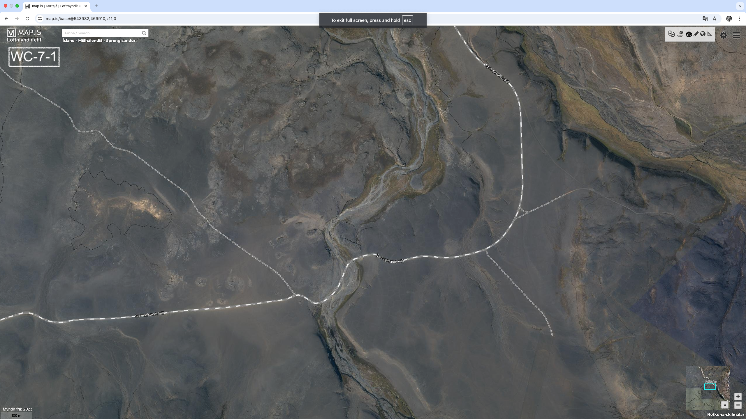
- WC-7-1 : 330.7 kms (64.72602, -18.07859) (image)
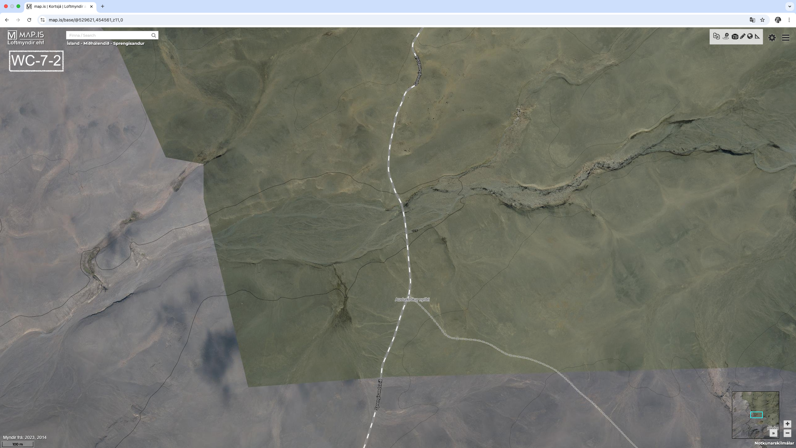
- WC-7-2 : 354.2 kms (64.59191, -18.38121) (image)
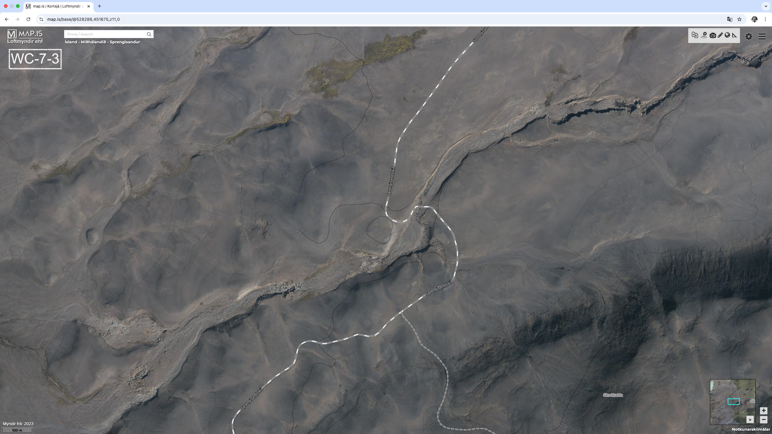
- WC-7-3 : 357.9 kms (64.56582, -18.40820) (image)
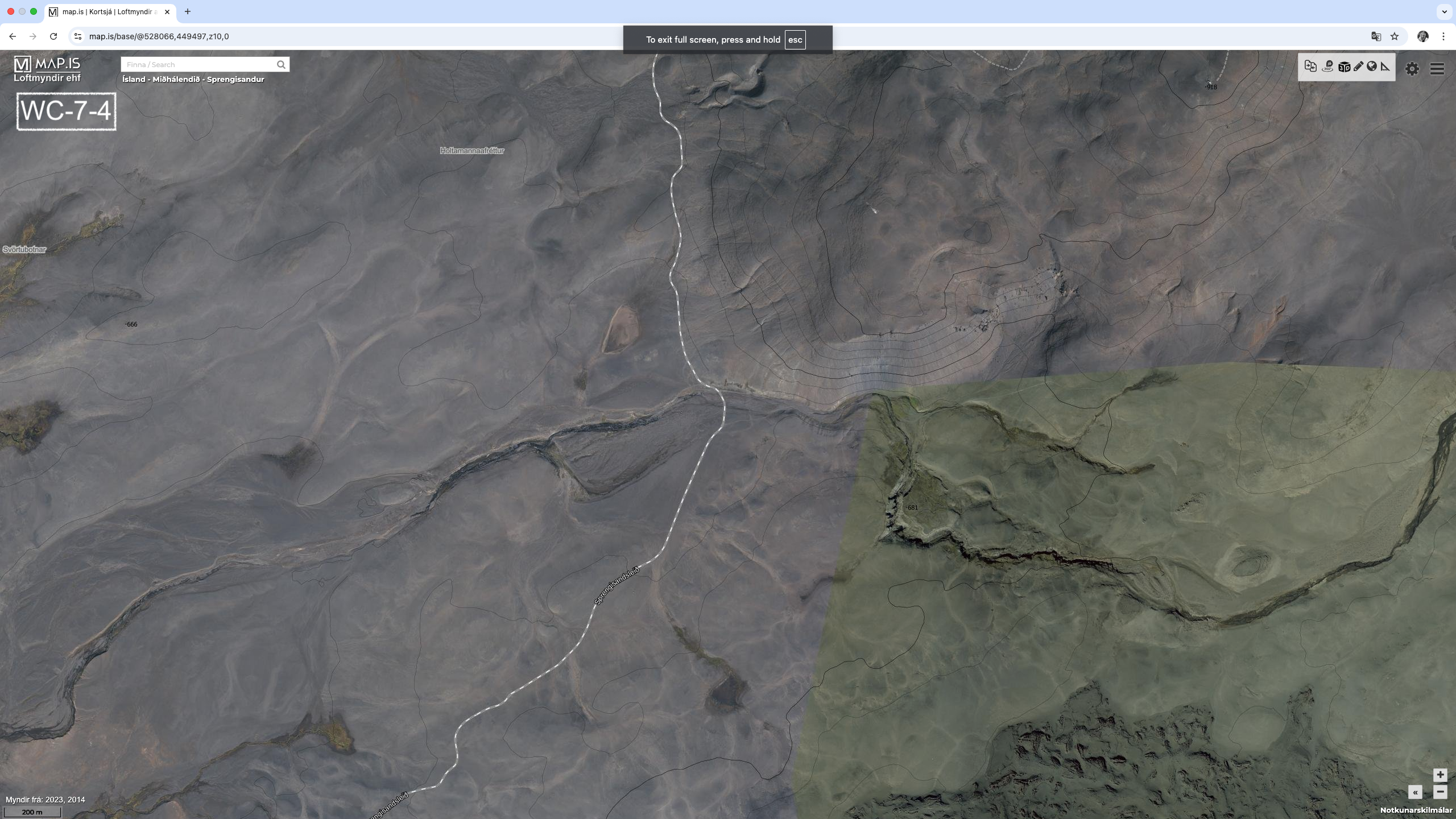
- WC-7-4 : 360.8 kms (64.54714, -18.41541) (image)
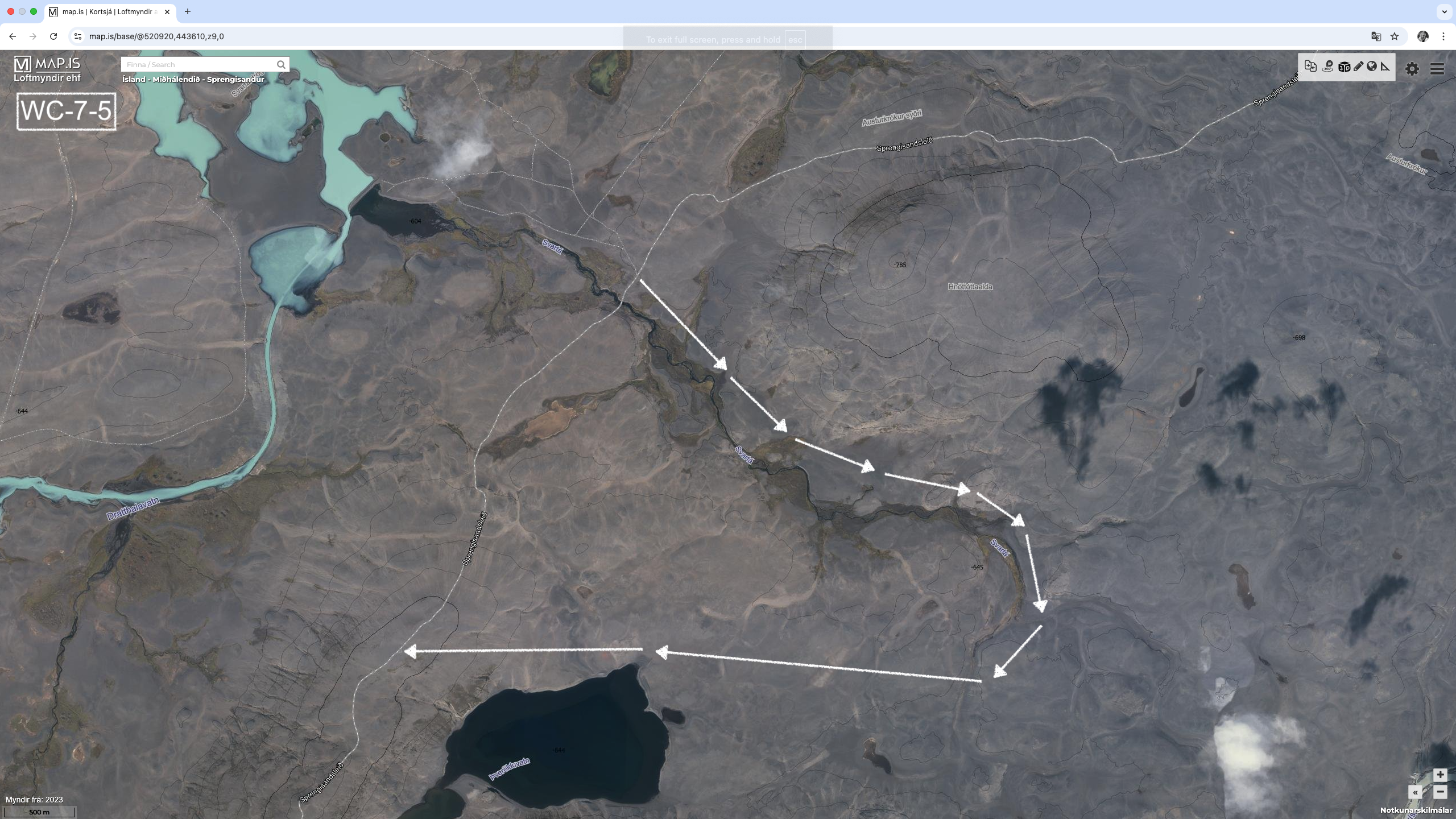
- WC-7-5 : 371.3 kms (64.50181, -18.58034) (image) – Svartá River – Red
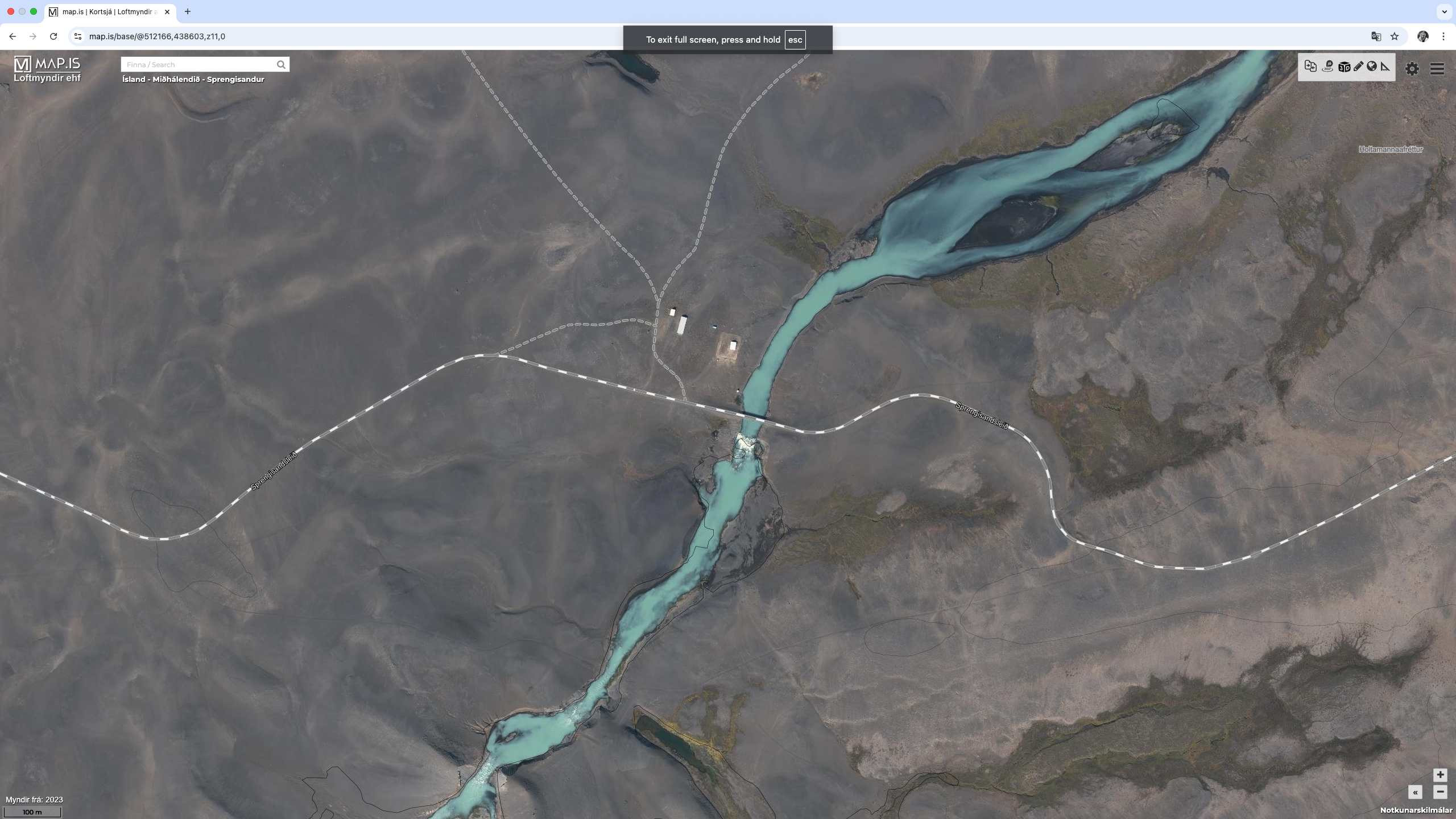
- WC-7-6 : 384.4 kms (64.44927, -18.74637) (image) – Bridge over the Illugaverskvísl River
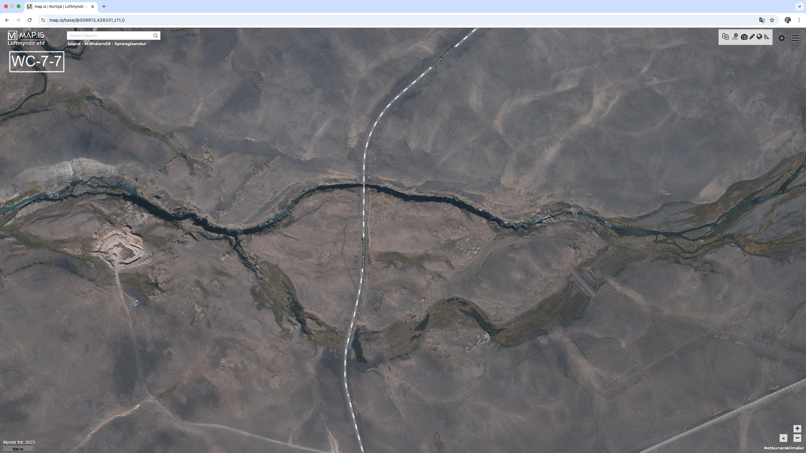
- WC-7-7 : 400.1 kms (64.35859, -18.85956) (image) – Bridge over Kaldakvísl River
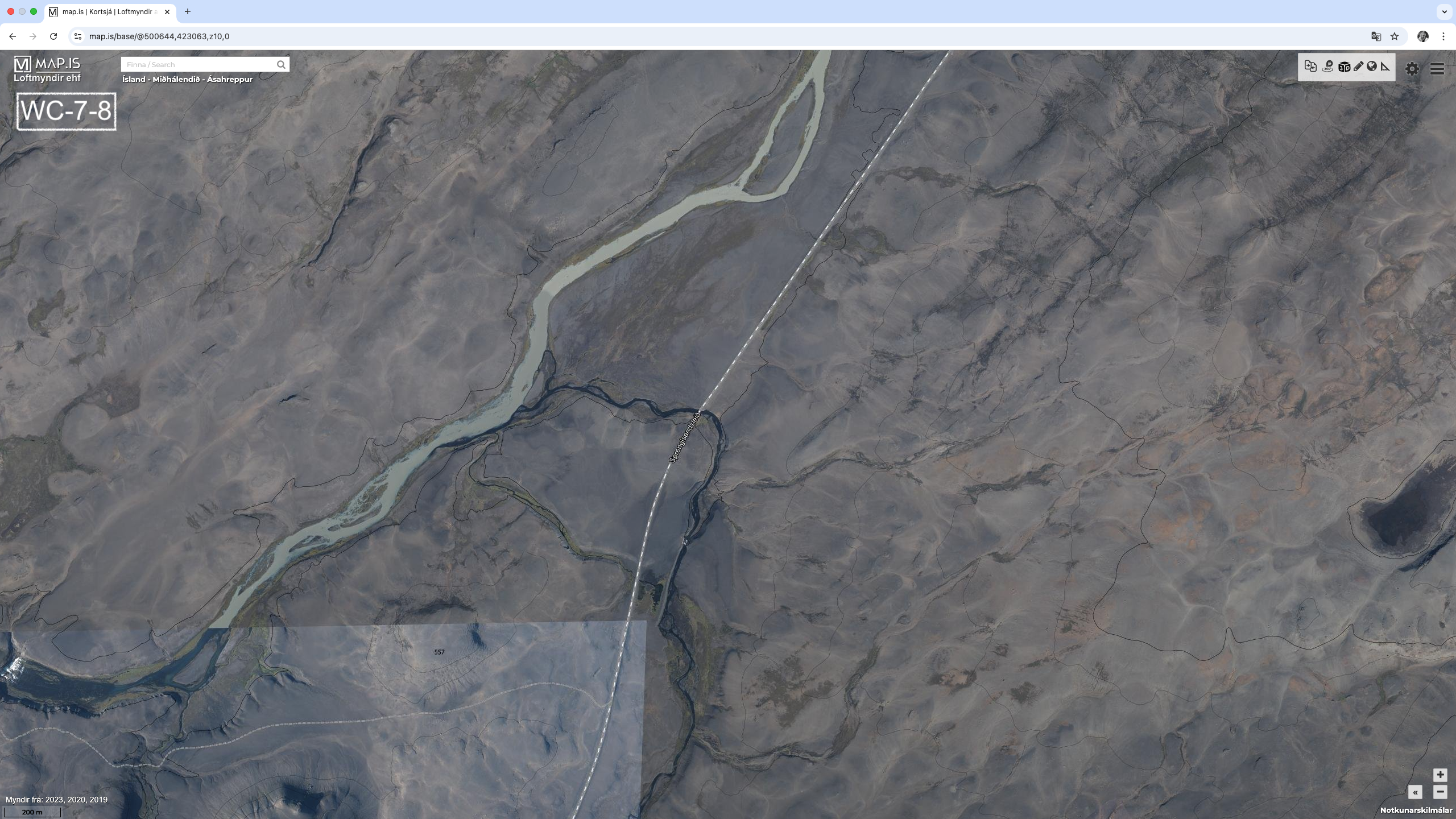
- WC-7-8 : 408.6 kms (64.30983, -18.97392) (image) – Bridge
The only problematic river crossing is over the Svartá River (WC-7-5). The good news, there is a bypass to the South and downstream. The bad news, it adds about 5 kms extra.
Access to drinking needs to be considered. After Nýidalur Hut, there is no sure water source until the Svartá River, some 41 kms away. So a water carry of 2 days is expected here. Maybe we will be able to ask some 4×4 drivers the situation for water as we walk. Drinking water after the Svartá River is no problem.
7.1 – Leaving via Vonarskarð
After leaving the Vonarskarð Geothermal Area, the alternative route of λ-1, that starts at the Kolufell Trailhead taking a route South in the direction of Jökulheimar Hut before turning West to pass to the South of Lake Þórisvatn. The route is a mix of existing dirt roads and parts where there are no tracks. The total distance is 106 kms. It would take about 4 to 5 days to complete.
The route to the Southern end of Lake Hágöngulón is along a dirt track. After leaving the lake, then we are more on our own. The route heads South to connect with the Dórleið track, some 25 kms away. And while this is off-trail, it has been done by someone in the past, and we have downloaded their GPS tracks. There is potentially a problem at the beginning of route, as we have to cross a dam (WC-7-λ5). If the dam is in flood, then the spillway could be active and we might not be able to cross, and we will have to back track. We connect with dirt track for 27 kms before a 5 kms stretch across open terrain where we are off-trail again. To the South there is a major road, and we are never too far away from it. There is also a road leading North back to the F26. Once at Lake Þórisvatn, we continue along dirt track for 24 kms to the end of the section.
Although there is some off-trail route finding, overall it is not too bad and there are escape options if needed.
The river crossings are:
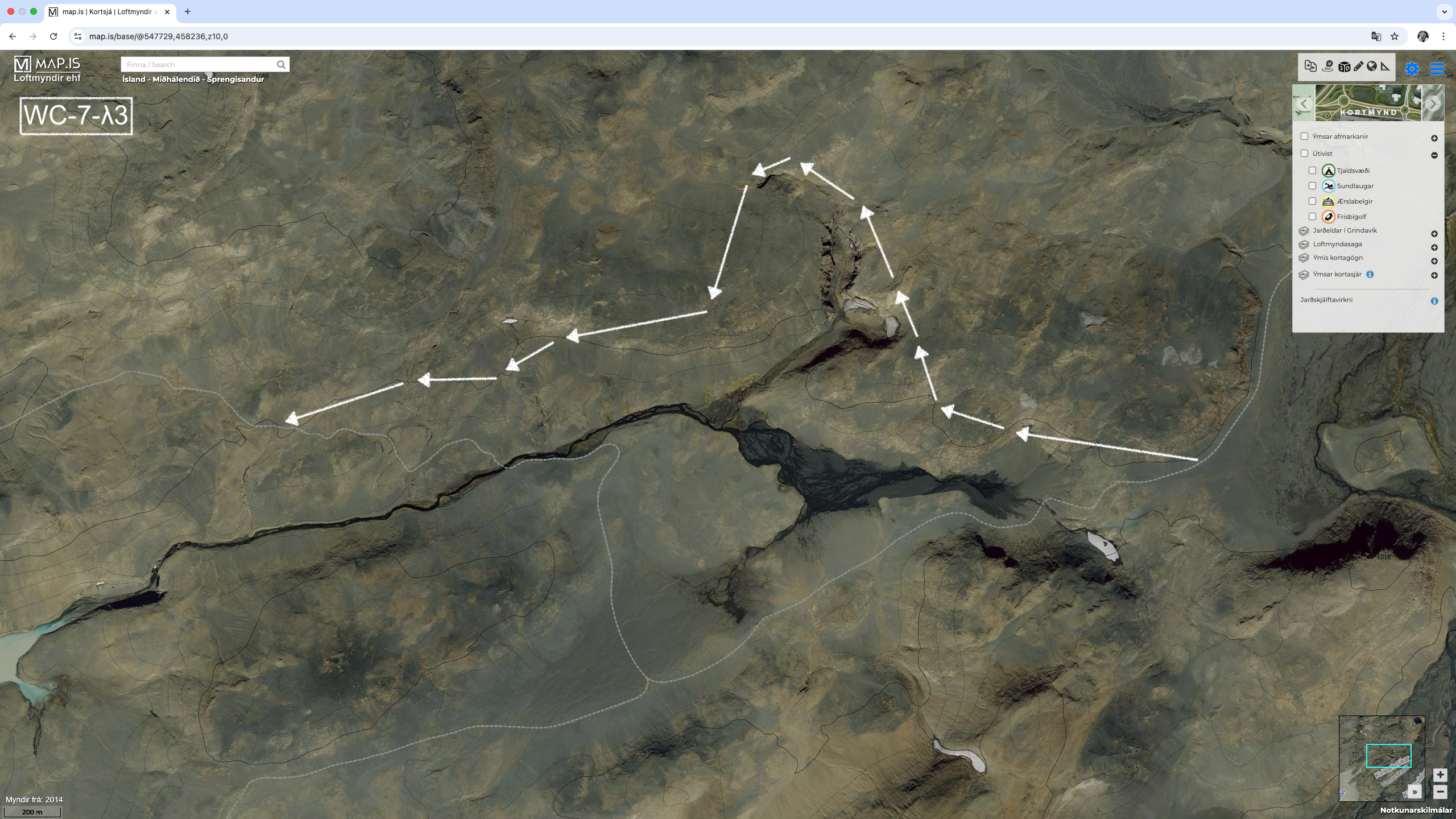
- WC-7-λ3 : (64.62099º, -18.01877º) (image)
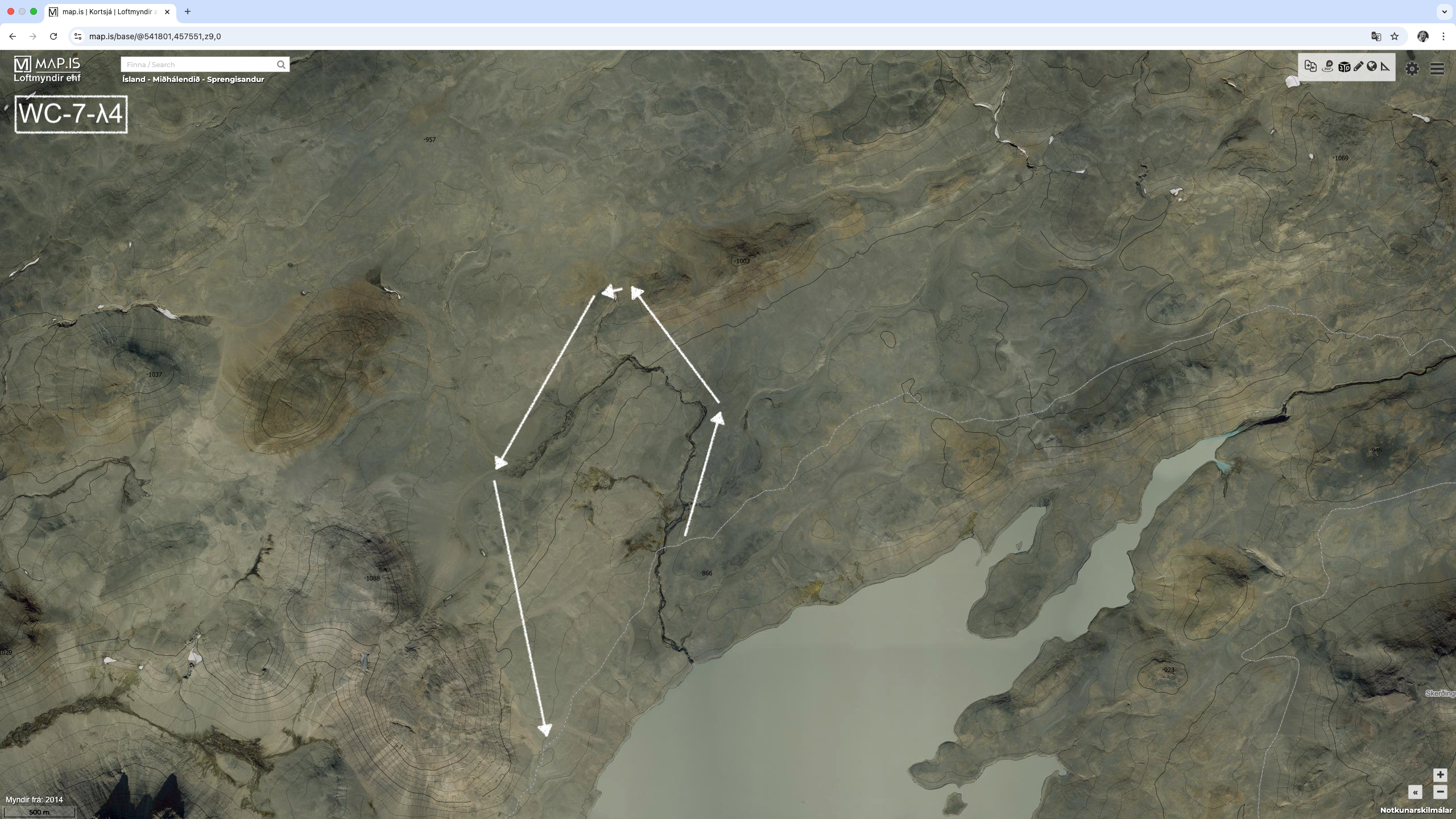
- WC-7-λ4 : (64.60937º, -18.13674º) (image)
- WC-7-λ5 : (64.53542º, -18.18872º) (image) – Dam
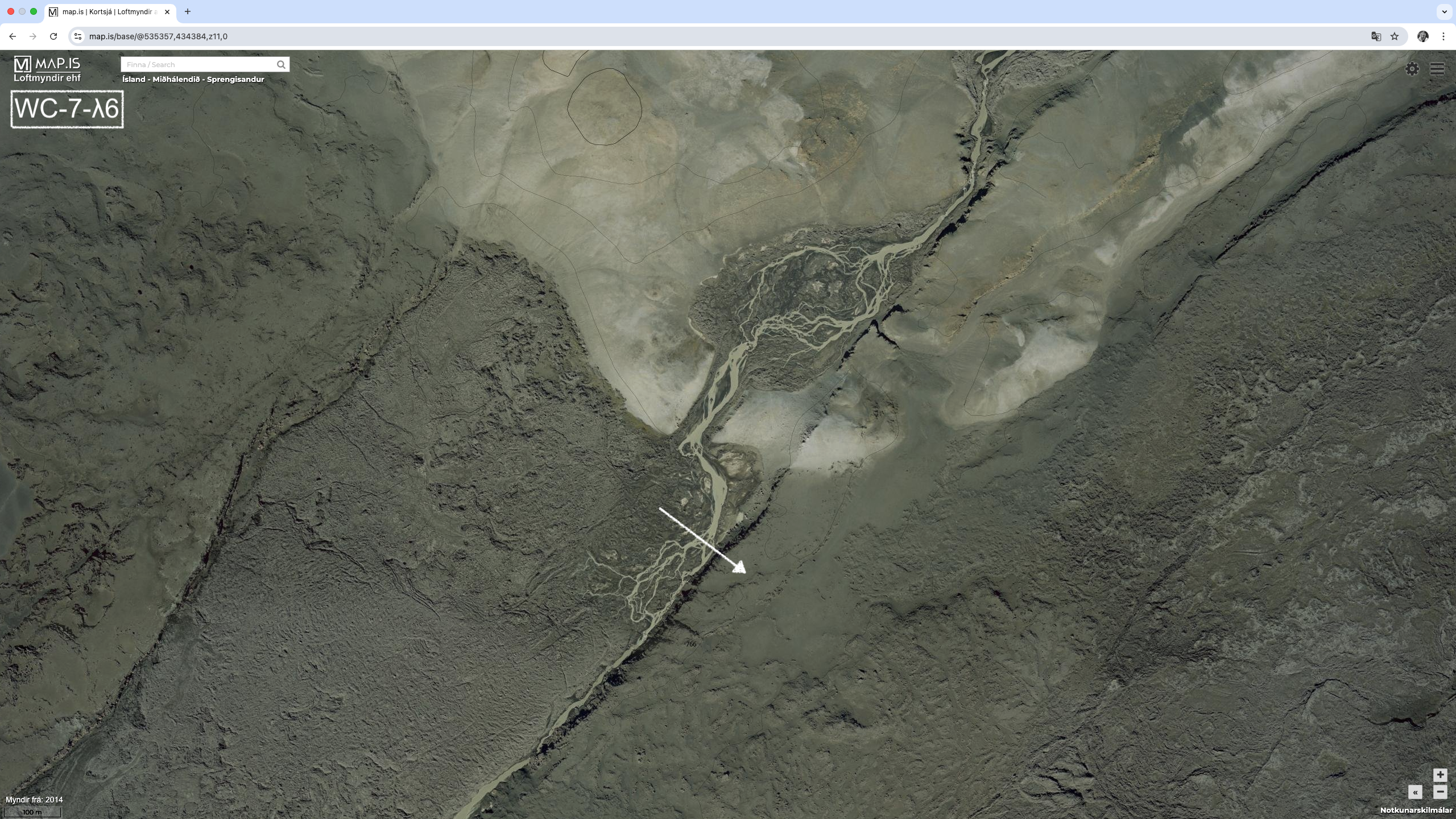
- WC-7-λ6 : (64.40725º, -18.26797º) (image) – WARNING – See Notes
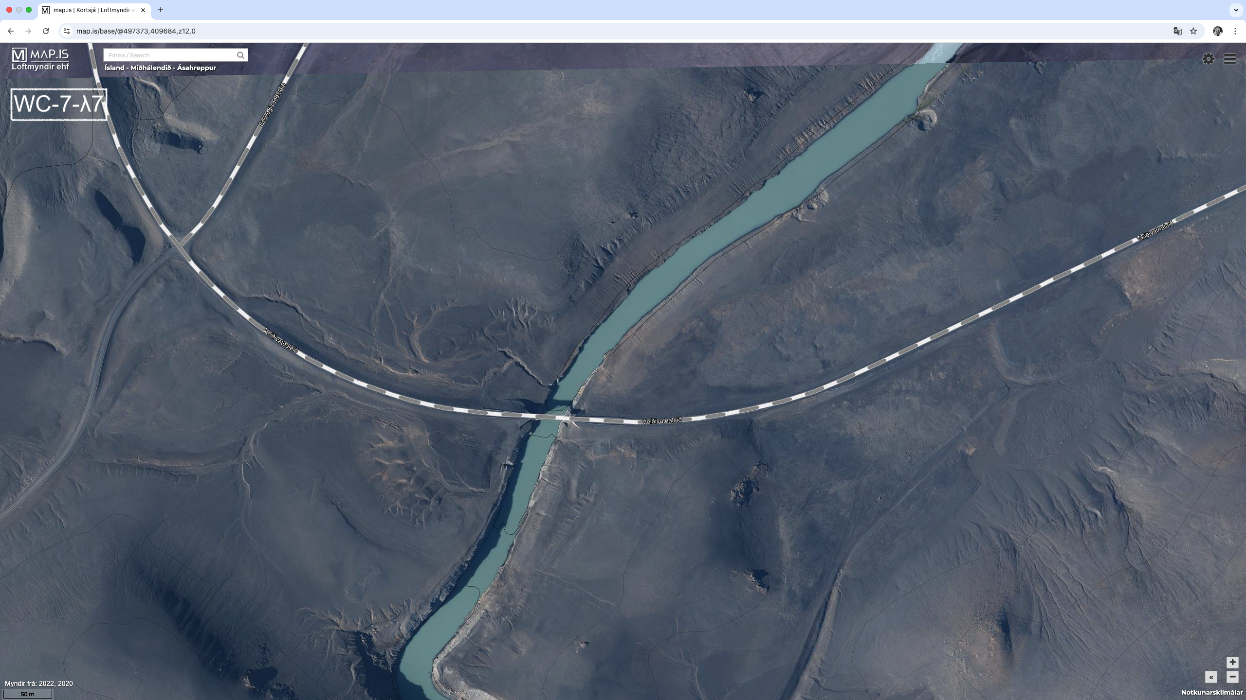
- WC-7-λ7 : (64.18937º, -19.05582º) (image) – Bridge
There appears to be a reasonable bypass for WC-7-λ3, to the North. It is about the same distance as the planned route. Unfortunately there is no obvious bypass for WC-7-λ4. Swimming in the lake might be the only alternative. WC-7-λ5 could also be tricky, if the dam is in flood and the spillway is active, as mentioned above. If this is the case, a back track looks like the only available option. The bridge at WC-7-λ7 should be open, but there is an alternative bridge 1 km to the North East.
WARNING: These is a report of quicksand at WC-7-λ6. So, need to be extra careful here. There is a possible bypass to the South. Also a report of a dangerous lava field; “It’s hell”, just to the North.
There is likely drinking water at the Kolufell Trailhead, which is 17 kms after Nýidalur Hut. Another 10 kms later there is more water and potentially a place to camp, or we could push onto Lake Hágöngulón. After leaving Lake Hágöngulón, water is reported at WC-7-λ6 which is 17 kms later. And then another 13 kms we approach Jökulheimar Hut (3 kms off the route), where water is available from the Tungnaá River or a nearby Lake. It is then a 24 kms stretch to Lake Þórisvatn, where water is available. Finally there is water 21 kms away at the end of this section, with water likely available along the way. So, based on all of this, we should not need to carry water.
The summary for this alternative is that it appears doable with enough escape options to secondary roads. Other alternatives further South look like they will have more challenges with water crossings and getting back to our food resupply in Landmannalaugar. They have not been investigated in detail at this stage.
8 – Langisjór Area
This section is not yet completed. But confident the trails in this section are very well documented. This section 140 kms long and will likely take 5 to 7 days to complete.
Alternative Routes Summary
A high level summary comparison between the base route and an example alternative route
| Base Route |
| Sealed Roads : 83.6 kms Gravel Roads : 142.2 kms Existing Tracks : 321.5 kms Route Finding : 20.1 kms Total : 567.4 kms |
| 21 to 28 Days |
| 52 Water Crossings |
| Longest Water Carry : 2 Days (x2) |
| Example Alternative Route (β-3, θ-1, κ-2, λ-1) |
| Sealed Roads : 40.2 kms Gravel Roads : 47.1 kms Existing Tracks : 404.9 kms Route Finding : 116.5 kms Total : 608.7 kms |
| 23 to 30 Days |
| 43 Water Crossings |
| Longest Water Carry : 2 Days (x1) |
The following is a further breakdown of the alternative route.
| Section 1 : β-3 |
| Norðurþing Area |
| Sealed Roads : 5.8 kms Gravel Roads : 19.0 kms Existing Tracks : 41.9 kms Route Finding : 16.5 kms Total : 83.2 kms |
| 3 to 4 Days |
| No Water Crossings |
| Drinking Water Available |
| Section 5 : θ-1 |
| Ódáðahraun Desert and Askja Area |
| Existing Tracks : 107.1 kms Route Finding : 40.8 kms Total : 147.9 kms |
| 5 to 7 Days |
| 1 Water Crossing |
| 41 km Water Carry |