
Iceland > Custom Maps
The following image was made in Mapbox Studio where it is possible to control when features, like roads or waypoints, are shown at various zoom levels. Here is how a custom map might look like. Note, example tracking points have been added in the North. This map is in beta. Click here to get a pdf of this map. Or smaller files, part 1, part 2, part 3 and part 4.

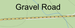
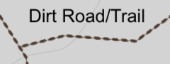
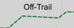

The map was made by extracting highway and natural data from Open Street Maps, see queries below, converting the query results to mbtiles and adding this information to Mapbox Studio. This allows us to control the zoom level for these features, and present smaller roads and natural points of interest even when zoomed out. The map was srtyled for outdoor use and custom icons were added which we thought we important. More information below on how this was done.
Overpass-turbo can be used to extract data from OSM. This query finds natural features of the landscape.
/*
This has been generated by the overpass-turbo wizard.
The original search was:
“(natural=cave_entrance or natural=rock or natural=stone or natural=volcano or natural=geyser or natural=fumarole or natural=hot_spring or natural=peak or natural=spring or waterway=waterfall) in iceland”
*/
[out:json][timeout:25];
// fetch area “iceland” to search in
{{geocodeArea:iceland}}->.searchArea;
// gather results
(
  nwr["natural"="cave_entrance"](area.searchArea);
  nwr["natural"="rock"](area.searchArea);
  nwr["natural"="stone"](area.searchArea);
  nwr["natural"="volcano"](area.searchArea);
  nwr["natural"="geyser"](area.searchArea);
  nwr["natural"="fumarole"](area.searchArea);
  nwr["natural"="hot_spring"](area.searchArea);
  nwr["natural"="peak"](area.searchArea);
  nwr["natural"="spring"](area.searchArea);
  nwr["waterway"="waterfall"](area.searchArea);
);
// print results
out geom;
This query finds all the useful pathways. Primary roads are excluded as they are already on the basemap.
/*
This has been generated by the overpass-turbo wizard.
The original search was:
“(highway=secondary or highway=tertiary or highway=track or highway=path or highway=footway or highway=road) in iceland”
*/
[out:json][timeout:25];
// fetch area “iceland” to search in
{{geocodeArea:iceland}}->.searchArea;
// gather results
(
  nwr["highway"="secondary"](area.searchArea);
  nwr["highway"="tertiary"](area.searchArea);
  nwr["highway"="track"](area.searchArea);
  nwr["highway"="path"](area.searchArea);
  nwr["highway"="footway"](area.searchArea);
  nwr["highway"="road"](area.searchArea);
);
// print results
out geom;
The overpass-turbo query is exprted and converted of the correct zoom level to tiles with
> tippecanoe -o Downloads/outdoors-route-types-v4.mbtiles -Z 2 -z 7 Downloads/outdoors-route-types-v4.geojson
> tippecanoe -o Downloads/outdoors-waypoints-v2.mbtiles -Z 2 -z 7 Downloads/outdoors-waypoints-v2.geojson
> tippecanoe -o Downloads/osm_highway.mbtiles -Z 2 -z 7 Downloads/osm_highway.geojson
> tippecanoe -o Downloads/osm_natural.mbtiles -Z 2 -z 7 Downloads/osm_natural.geojson
This link is important to import custom maps into Gaia. Not used with Mapbox Studio.